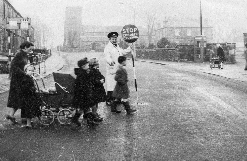
Great Harwood Revisited: A Walk Through History
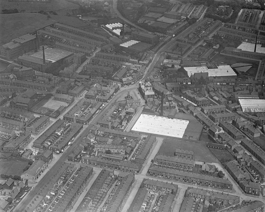
Aerial view of Great Harwood in the 1930s
This page will take you on a historical journey around Great Harwood, starting from the Town Gate, the hub of the town.
The text and photographs published here are in the main taken from a book published some years ago by Great Harwood History Society, which group was made up of myself, Ian Fairclough and Cris Kydd. Some of the photos are familiar, having been published in various places over the years, but some of them are unique and have been acquired by the above mentioned group – sadly now disbanded.
Text and historical information has been kept to a minimum in order to give the photographs priority. If you are interested in reading further about the history of the town a list of publications is listed at the end of the article. Most of these can still be obtained from a local library, some out of copyright items are available online.
Many of the photographs were owned by the former Great Harwood History Society, and the rest were contributed by:
- Accrington Library and Great Harwood Library
- Great Harwood Civic Society
- Great Harwood Appreciation Society Members and Great Harwood Genealogy and Local History Facebook Group
- The late Jim Halsall and Alan Parkin
Please note that many of these photographs will be subject to copyright.
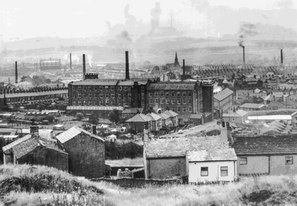
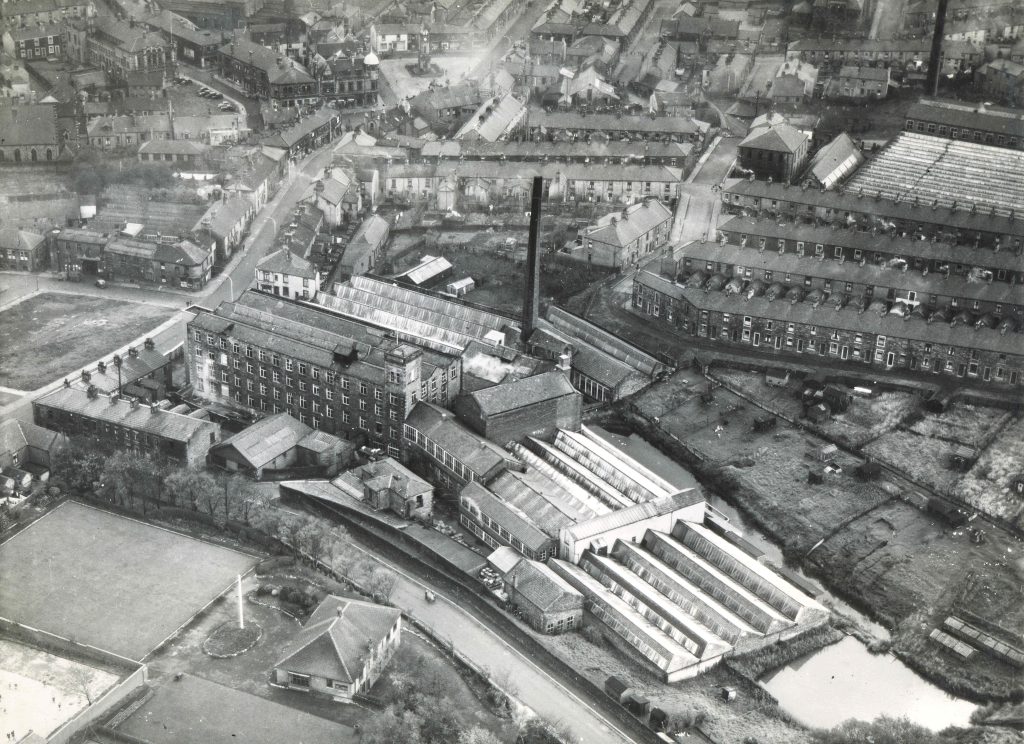
Above is a view of Great Harwood in 1963 taken from above Edge End cottages, the skyline dominated by mills and factory chimneys.
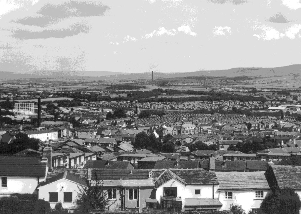
View of Great Harwood 1993. Most chimneys, and the industry they represented, have disappeared in the thirty years since the photo taken in 1963.
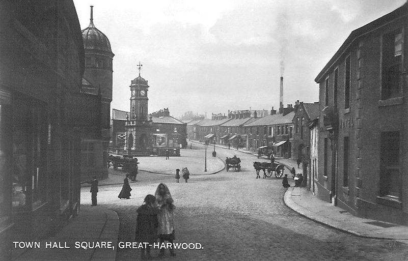
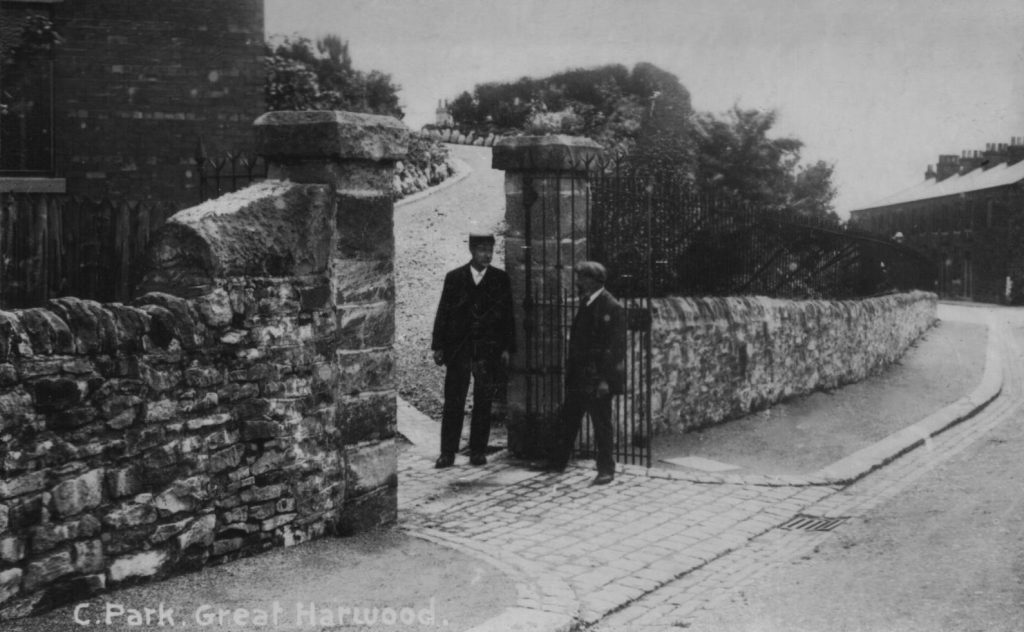
The start of the walk
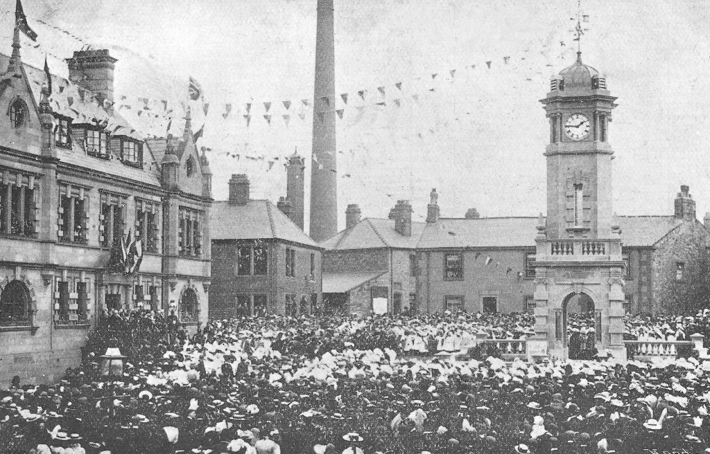
The clock tower on the Town Gate is a memorial to John Mercer, the chemist born in Great Harwood who invented the process of Mercerisation. It is often said that the object on the top of the tower is a snuff box – this supposedly being the explanation as to why Great Harwood is sometimes called ‘Snuffy ‘Arrod’, but this quote from the booklet produced at the time of the unveiling of the clock reveals what the object is: “Crowning the dome is a finial or weather vane. The feature of this is the Mortar and Pestle – symbolical of John Mercer’s work.”
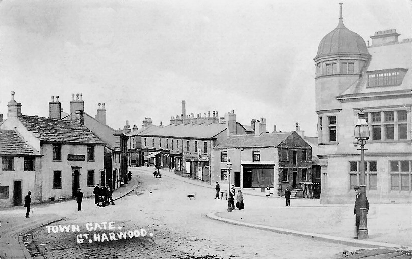
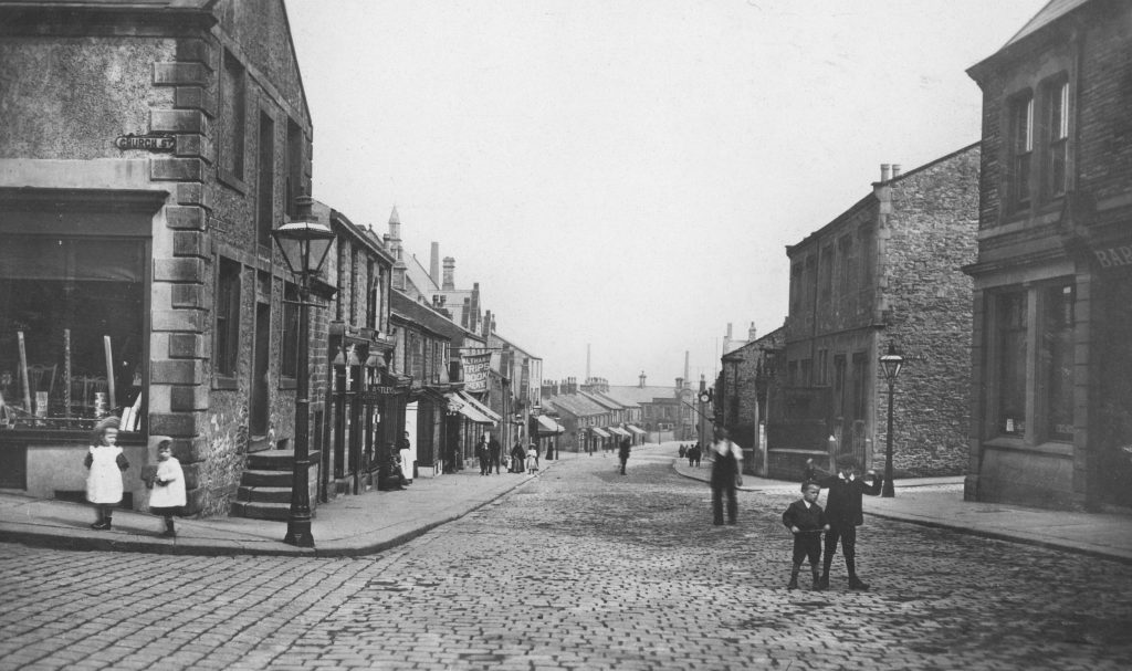
This view of Town Gate dates dates from around 1906, or possibly just after that year, which is when the Queen’s Head Hotel lost its licence in favour of the Park Hotel; compared with the next photo it has no signage indicating the licence holder.
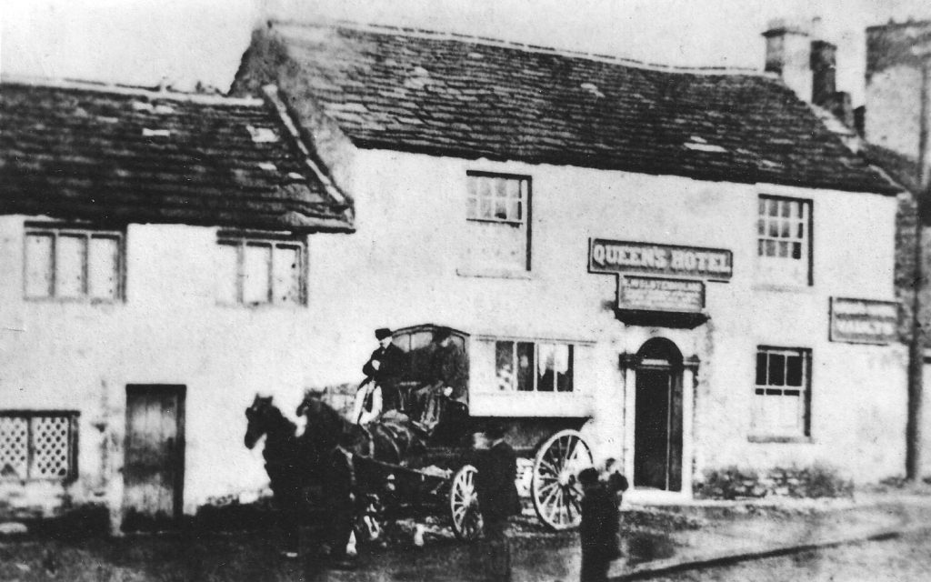
The Queen’s Hotel closed on the 7 February 1906 after a long history as an inn and also a farm. It had been an inn since at least 1754 when Lawrence Walmsley either acquired or renewed the lease on the buildings and land; he is shown in the parish register of St. Bartholomew’s Church to have been a weaver and innkeeper in 1739. The public house and farm stood on land formerly known as Feilden’s, and it is quite possible that there was an inn here since the 1600s; Randle Feilden and Henry his son were both alehouse licence holders in the town in that century.
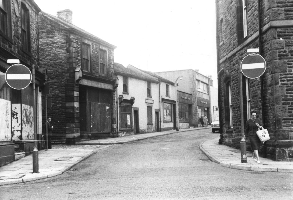
Two views of Town Gate from Church Street, the one on the left from the early years of the 20th century and the one below from the middle years of the century.Cars have replaced horse power in the second photo and the cobbles have been covered by tarmac.
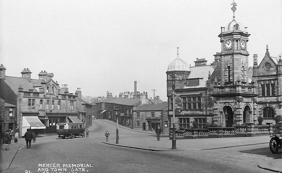
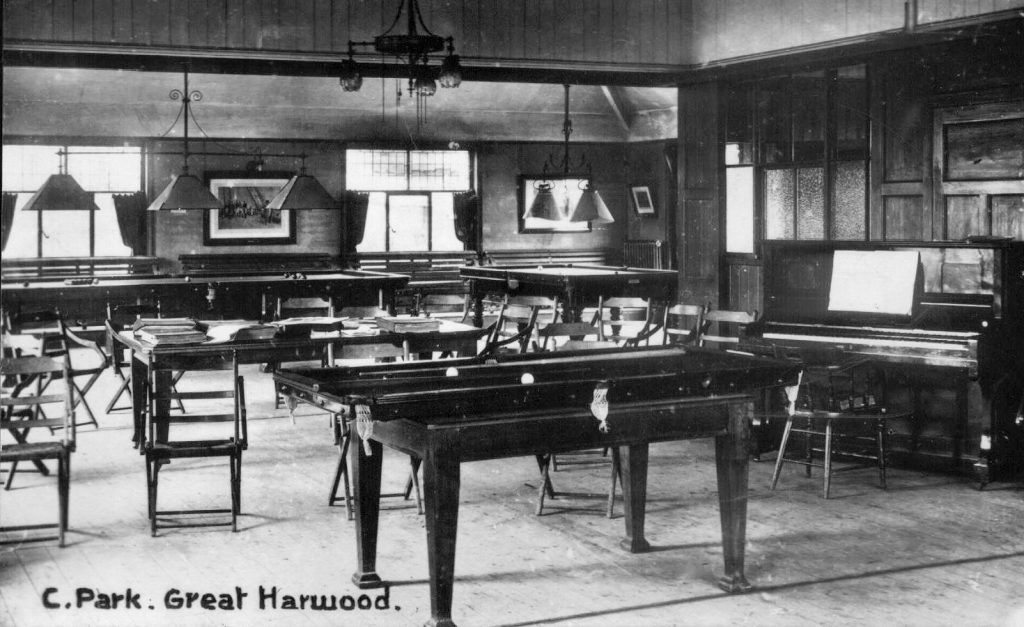
This view of Town Gate probably dates from the 1920s. The buildings that replaced the Queens Hotel were shops with a billiard hall behind that was reached by an entrance and steps just to the left of the bus.
The billiard hall on the Town Gate later became the Savoy Skating Rink. Many people remember fondly the owner, Len Mercer, pictured here.
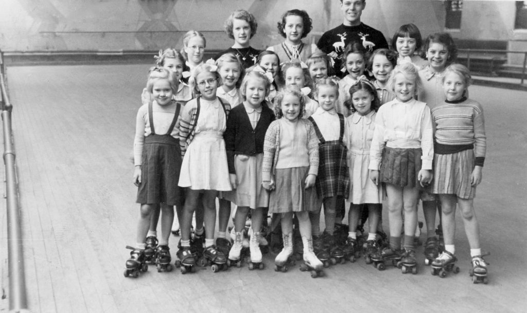
Group photo of girls at the roller skating rink circa 1960. For a time skating was a very popular pastime for the town’s children.
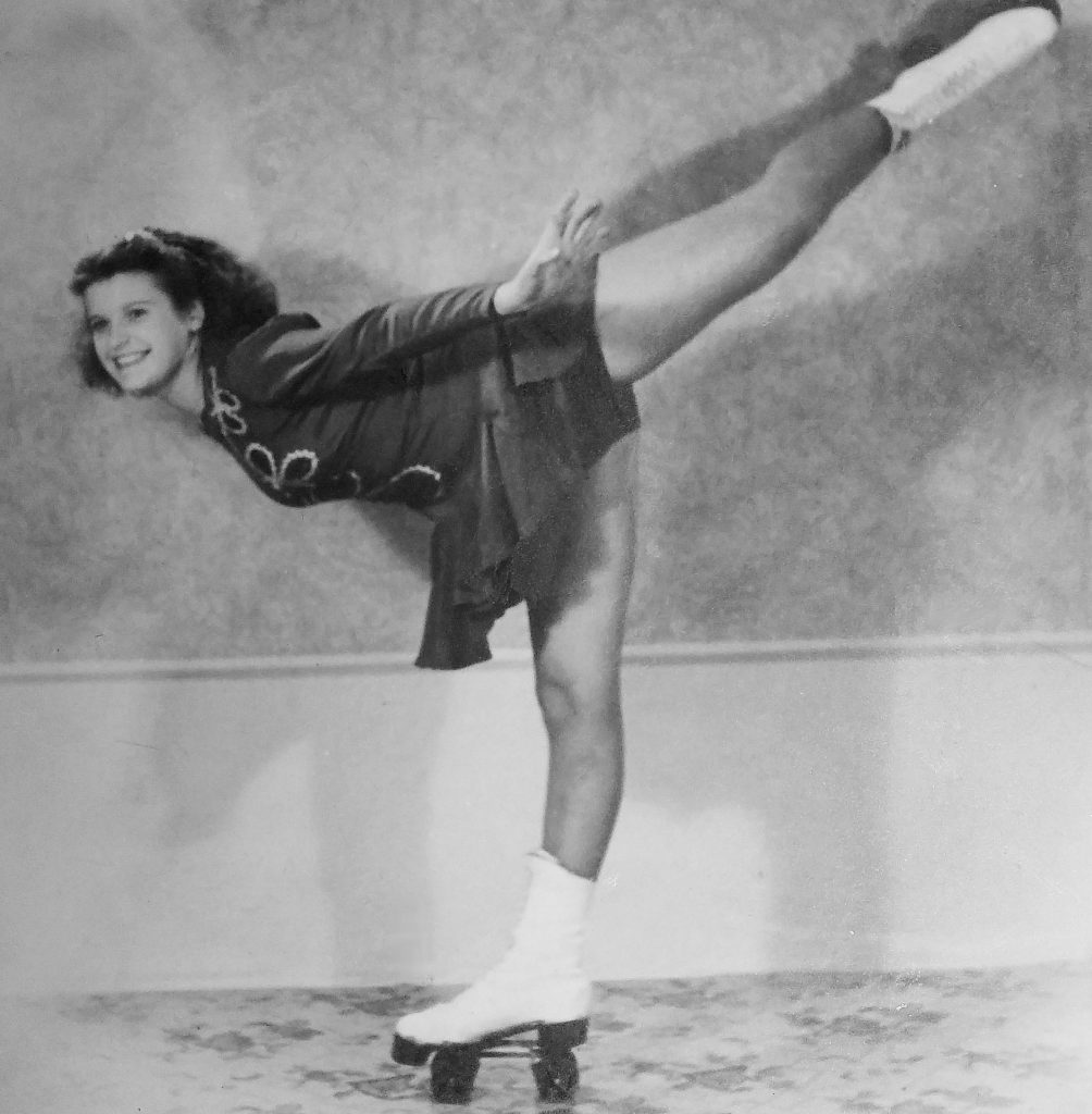
As well as keeping the children of the town happy the rink produced champions. Marion Mercer, daughter of Len Mercer, and her partner Edward Ellis were World Roller Dance Champions in 1954. They also appeared on television in that year in ‘Roller Rendezvous’. The Great Harwood Roller Hockey team won the National Cup in 1954 and 1957 with Norman Mercer, son of Len, being named the most outstanding player.
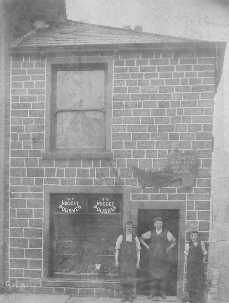
Now pulled down, this clogger’s shop was next to the former Wellington Hotel on the corner of Delph Road.
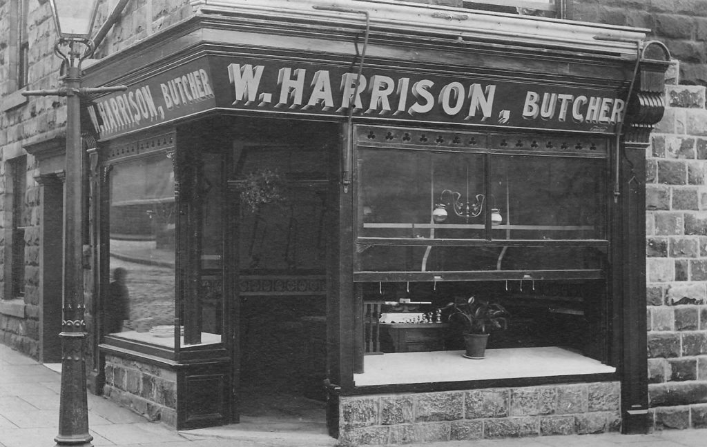
Harrison’s butcher shop was on the corner of Town Gate and Commercial Road. William Harrison rented fields in the town near the Victoria Hotel, and that is probably why, when the railway was built, the bridge to the fields became known as ‘Butcher Brig’. The railway and bridge are long gone, but the Victoria Hotel is still known by that name.
On Town Hall Street, originally called Police Street, stands this building, the town’s first police station. Built in 1879 it remained the police station until a new station was built on Blackburn Road in 1905. For a time there seem to have been two buildings serving the town as a police station – sometime between the census years of 1881 and 1891 a house at 26 Cliffe was home to a police constable and his family, and was probably a sub station.
These two cottages at the bottom of Church Street and facing Town Gate are amongst the oldest surviving buildings in the town centre.
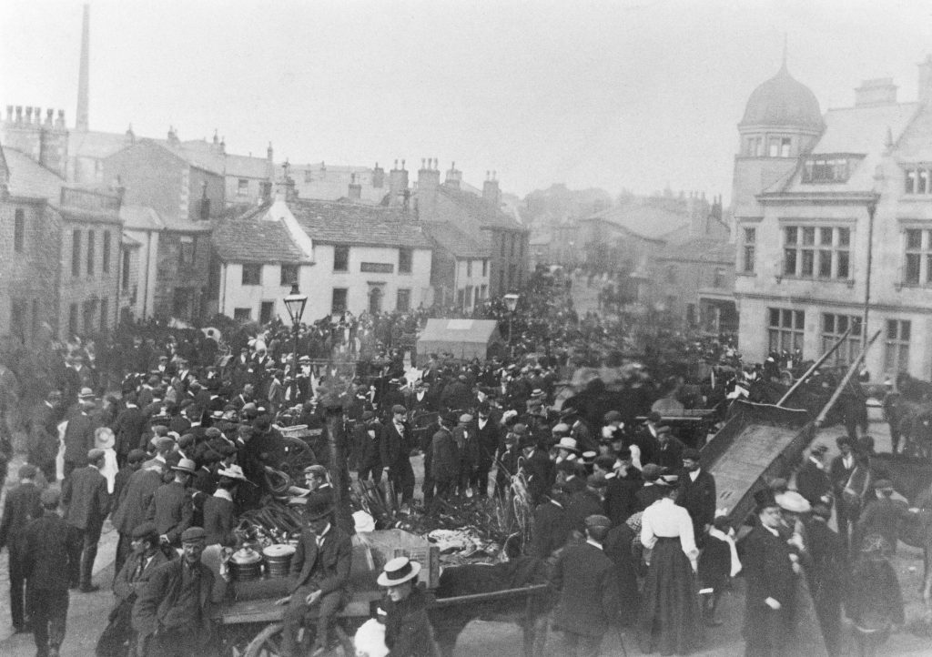
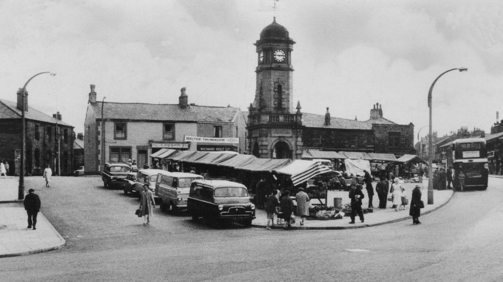
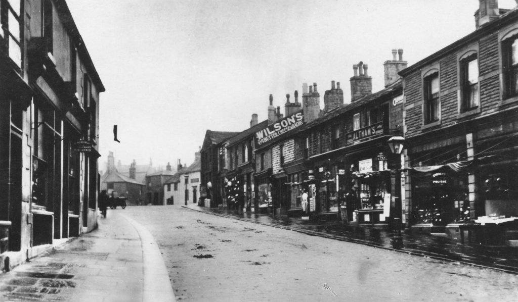
On the 26th June 1338 Adam Nowell was granted the right to hold a weekly market and a fair annually, for his manor of Netherton in Great Harwood, by King Edward III.The market has declined greatly in the last 20 years or so, but many will remember how busy it was each Friday.
The photo above may be of the annual fair early in the 20th century, whereas the photo on below shows the market in the 1970s. As can be seen, both of these events were taking place on what we now know as the Town Gate; however, before 1900 this area was the site of farm buildings so neither event could have taken place exactly where shown in these photos.
These buildings stood in the centre of the town, on Town Gate, and were demolished around 1900. At one time it was the largest farm in the Lower Town and the buildings covered most of what is now the cobbled area surrounding the Mercer Memorial Clock.The buildings on the right of the photograph have been estimated to be possibly late 1500s to early 1600s.
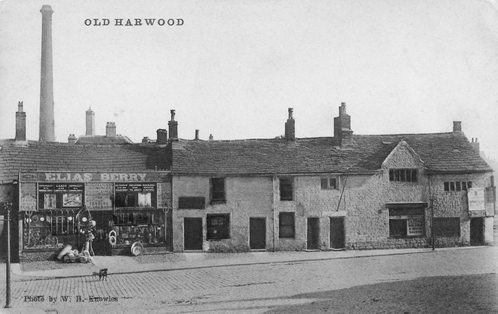
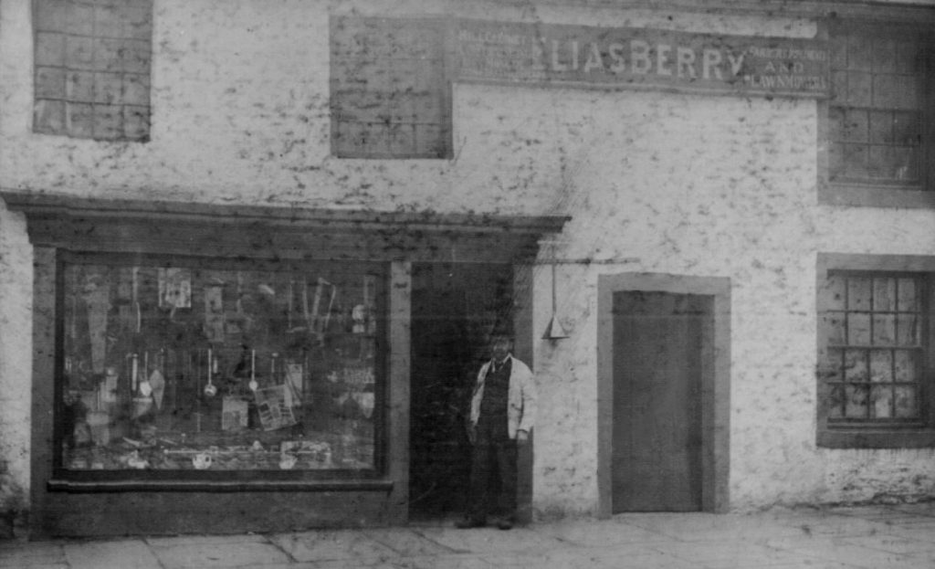
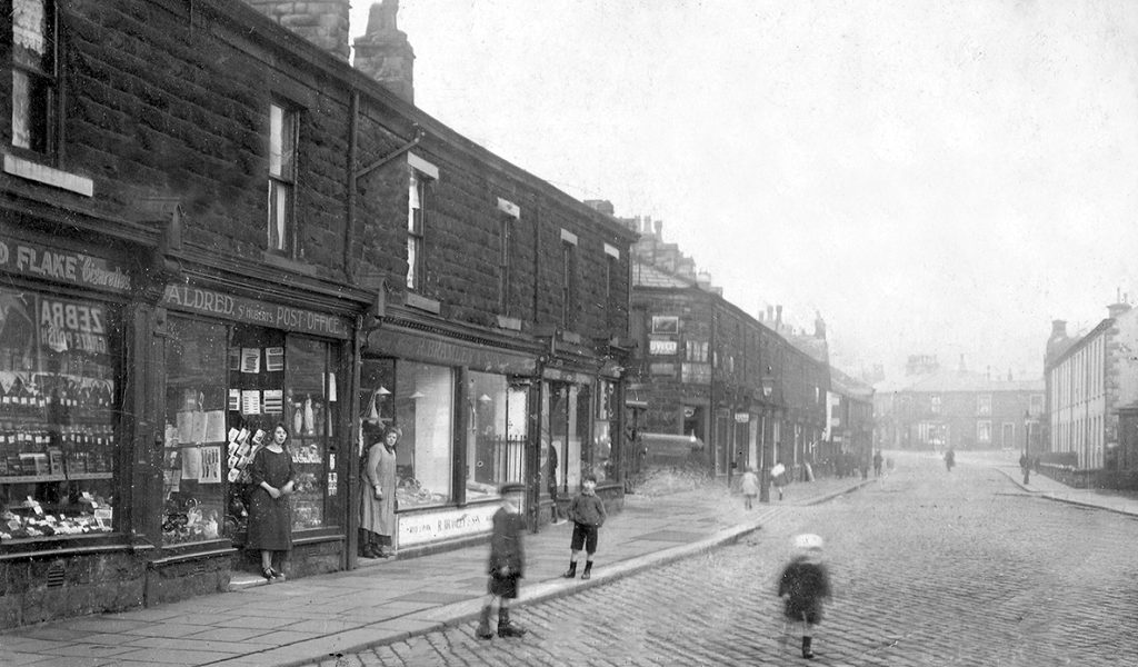
In the photograph above is the ironmonger’s shop of Elias Berry; the photograph below shows the same shop, but at an earlier date. When the shop was demolished he moved his business to 28a Queen Street, across the lane from the Walmesley Arms. He also had a shop on the corner of Mercer Street and Queen Street.
This view of Queen Street from Town Gate shows, on the right, just beyond Glebe Street, the National School.Built in 1836 this was the first school built since a school at Butts was opened in the 17th century.
This view of the National School was taken from Glebe Street.
Another photograph of Queen Street from Town Gate. The National School had been demolished, ceasing to be a school in the early 20th century when pupils were transferred to the new Parish School on Ash Street.
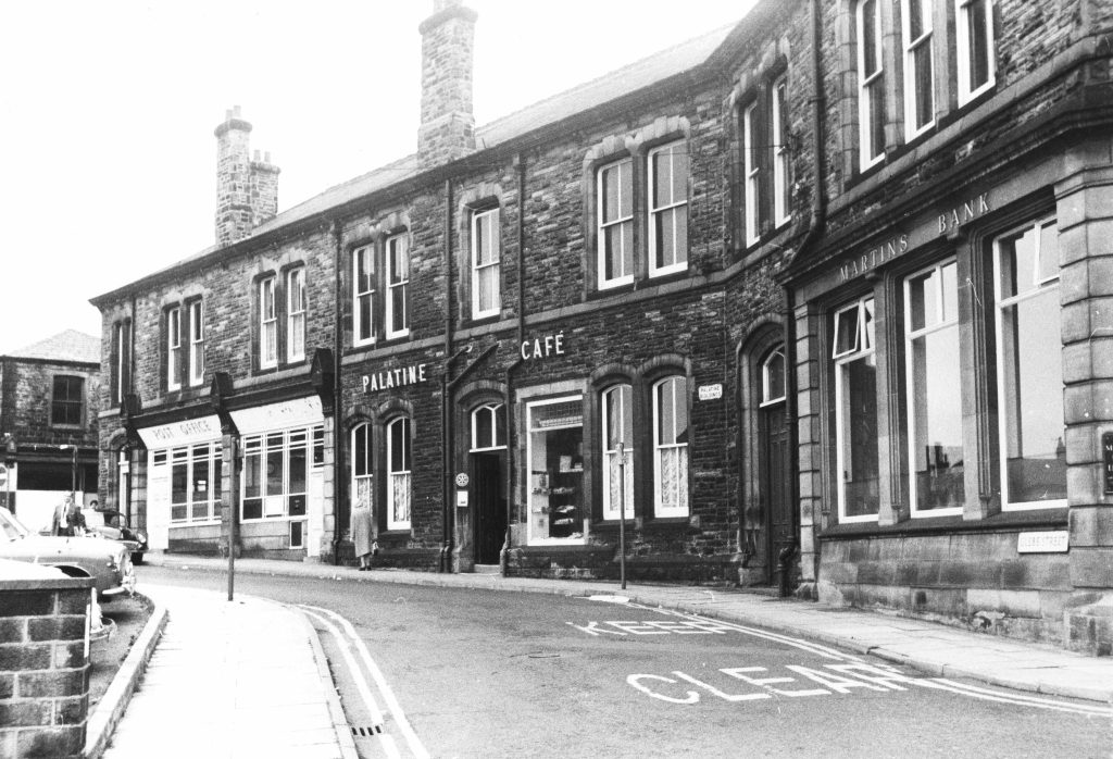
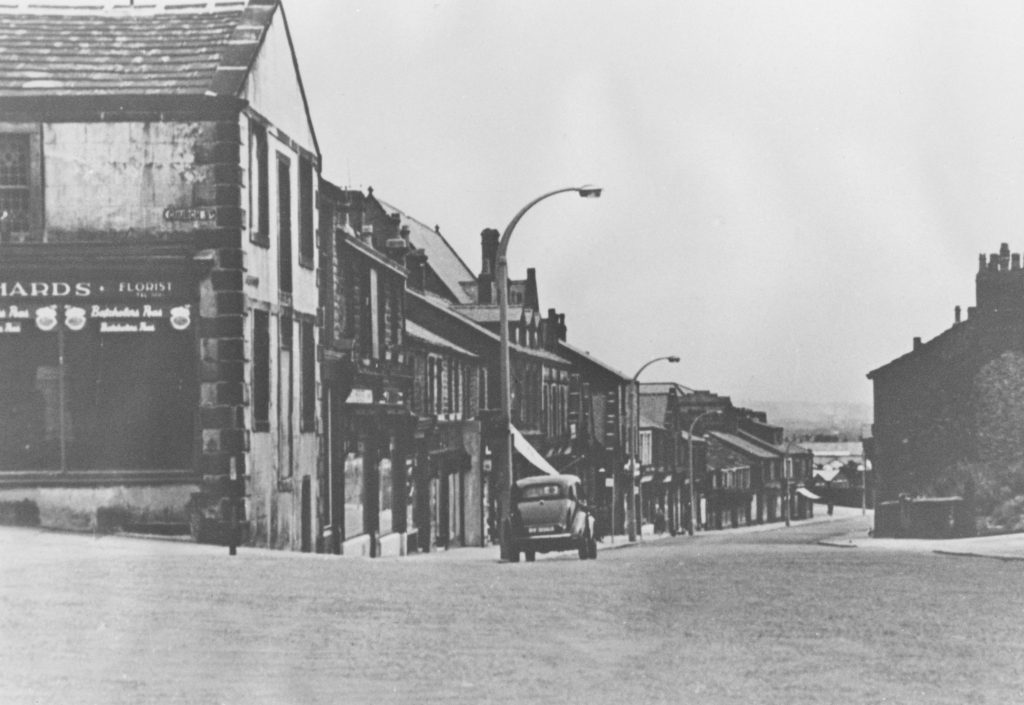
Glebe Street, showing the former Palatine Café and bakery.
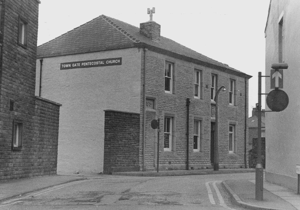
Curate Street, so called because the Vicarage, built in 1789, was sited on the street, where the old Co-operative Society buildings now stand. The building on the left in the photograph was the main Co-operative Society grocery for many years until the late 1950s.
The Vicarage, built in 1789, faced onto what is now Loynd Street, but which then was farmland. A new vicarage was built in 1902 on Cliffe Lane opposite the church and the land was sold to the Co-operative Society.
The Co-operative Society building on Glebe Street. In the 1960s the various departments closed and were made into the first modern supermarket in the town.
Two views of Queen Street looking towards Town Gate.
In the first the old Queen’s Head Hotel is still visible, putting the date of the photograph at around 1906. What appears to be a flying boot is the sign for a cobbler’s shop.
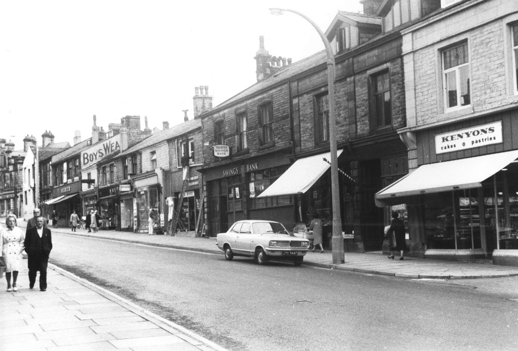
Somewhat later in date, the 1970s, this shows shops and services that had been on Queen Street for many years: Trustee Savings Bank, Kenyon’s Bakers, Mercer’s Mens Wear.
The Congregational Church was founded in Great Harwood by Roger Cunliffe, a native of the town and a banker based in Blackburn. The photograph above shows the first purpose built church, erected in 1837.
The original church was replaced in 1888 by the building shown in the photograph above. This too has now been demolished – services having moved to the former British School in Barnmeadow Lane. The site on Queen Street is now occupied by a funeral directors and newly built shops.
Erected on the site of Dugdales farm, where once Congregational services were held in an upper room, this shop became one of the ironmongers shops of Elias Berry in early 1900, replacing that on the Town Gate.
Off Queen Street is Joiner’s Alley, so called since about 1874 because of its connection to the Birtwistle family, woodworkers in the town since the early 1700s.
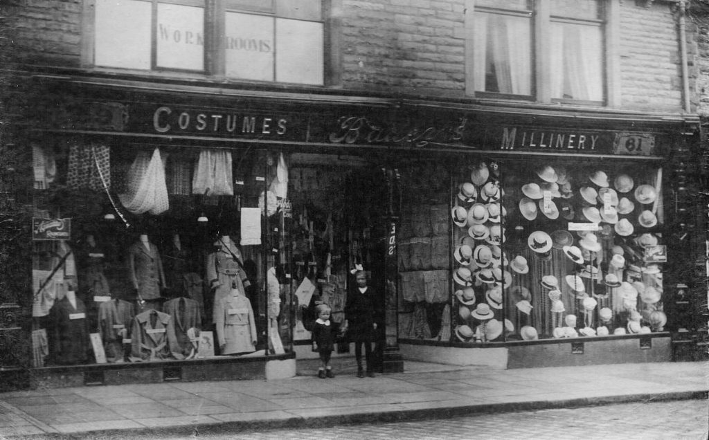
Located at 59-61 Queen Street, Bailey’s was the place for the ladies of the town to buy fashion.
Britannia Mill stood where the library and supermarket car park now stand. Although not the first cotton factory in the town it was one of the early ones built in 1849 by John and Robert Mercer the sons of John Mercer the chemist, and Joseph Haydock. It was leased to Birtwistle and Walmesley in 1850.
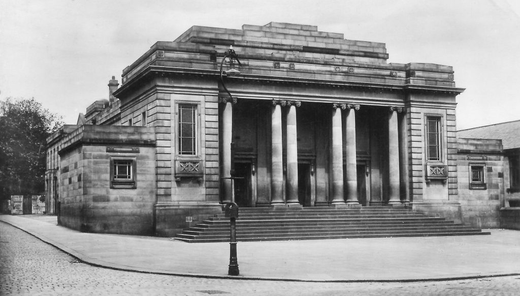
Built with money left for the benefit of the town by Maria Mercer, the last surviving child of John Mercer the chemist, work began on the Mercer Hall 1813, but it wasn’t completed until after WWI in 1921.Before it was converted to the swimming baths in 1966-67 it was the scene of many dinner dances and events.
The present library replaced this building of 1959, which stood where the supermarket and car park are now located. It was demolished in 2000 after the land was purchased by the Co-operative Society.
Many older readers will remember the building pictured above and may even have spent part of their early years here.Queen Street Day Nursery stood behind where the library now stands and had lawned playing areas fronting on to Queen Street.
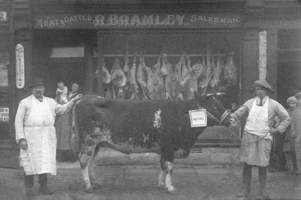
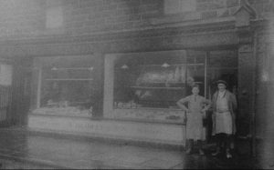
For many years the Bramley family had a butchers and a grocery shop on Queen Street, opposite the Plough Inn.
These photos date from the 1930s; in the photo above right the Britannia Mill can be seen.
Plough farm barn, cottages and Britannia Mill on Queen Street in the 1930s.
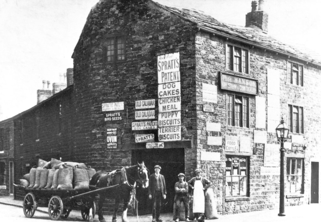
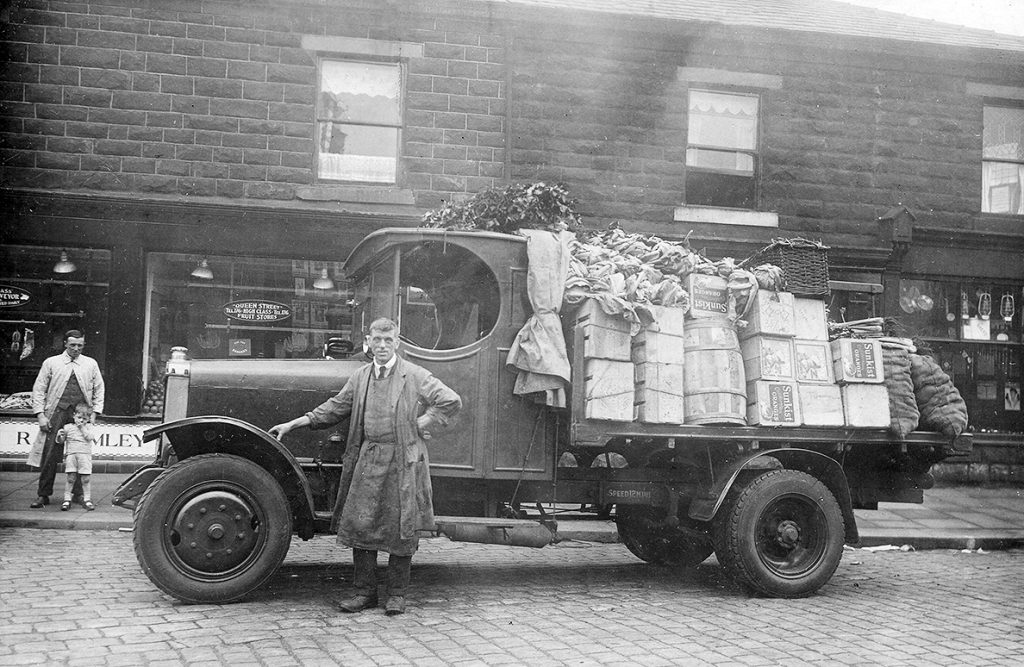
A well known firm in Great Harwood, Hanson’s supplied animal feeds. This store stood at the corner of Queen Street and St Hubert’s Street, opposite the Plough Inn.The upper room was used as a meeting place for the Roman Catholics before St Hubert’s Church was built in 1857.
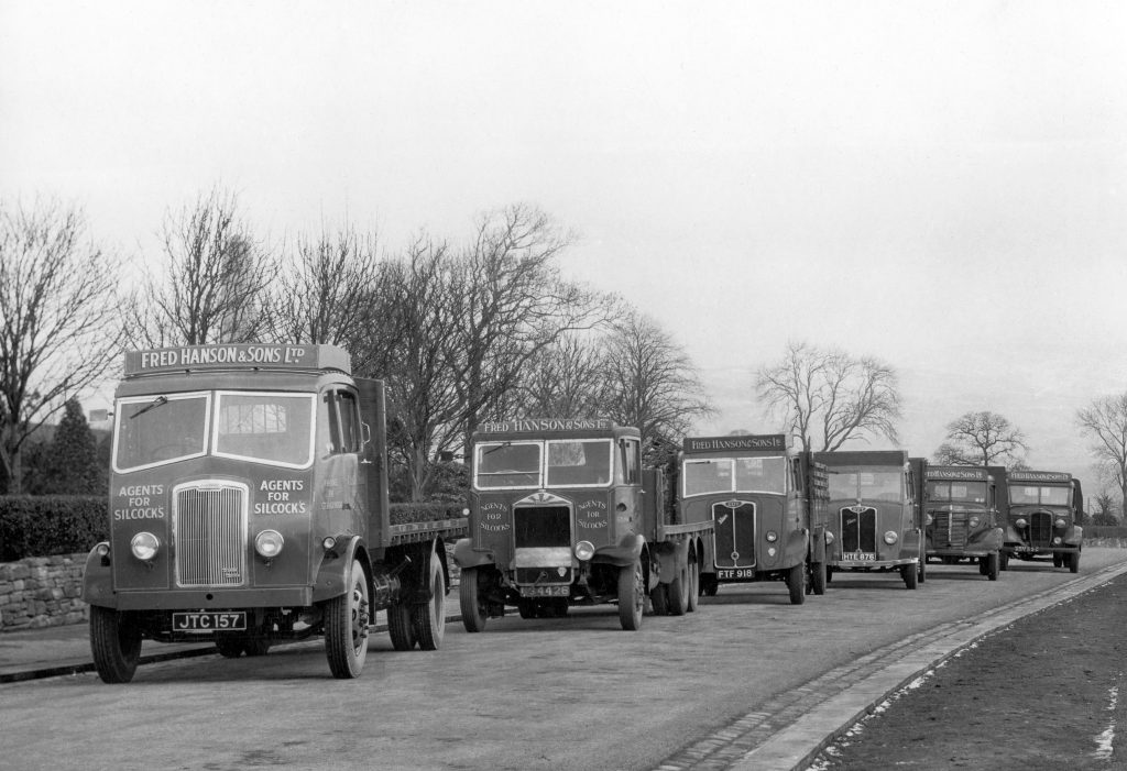
Hanson’s fleet of trucks.
A view of St Hubert’s Street from Queen Street. The church spire can be seen, and the school buildings.
The Ordnance Survey map of 1844 shows cottages where these are in the photograph above, and could very well be the same cottages. The cottages were demolished in the 1960s.
These terraced houses on Lower Queen Street were also demolished in the 1960s.
Park Road from Lomax Square.
The North Lancashire Loop Line, running through Great Harwood, linking Rose Grove in Burnley with Blackburn, opened in 1877.
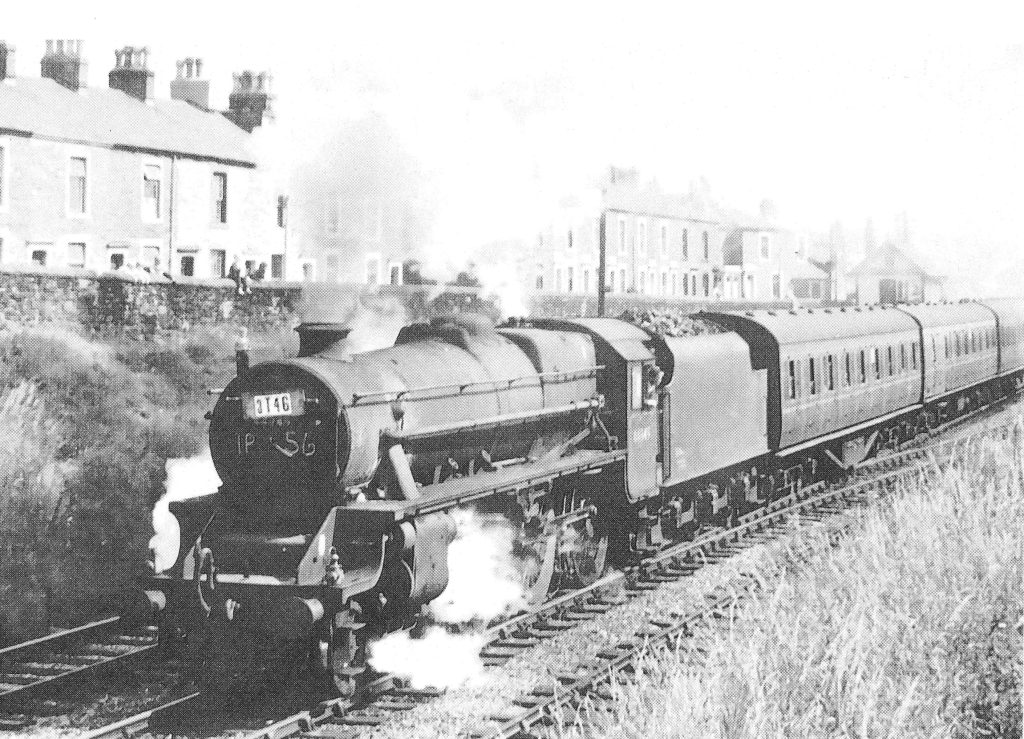
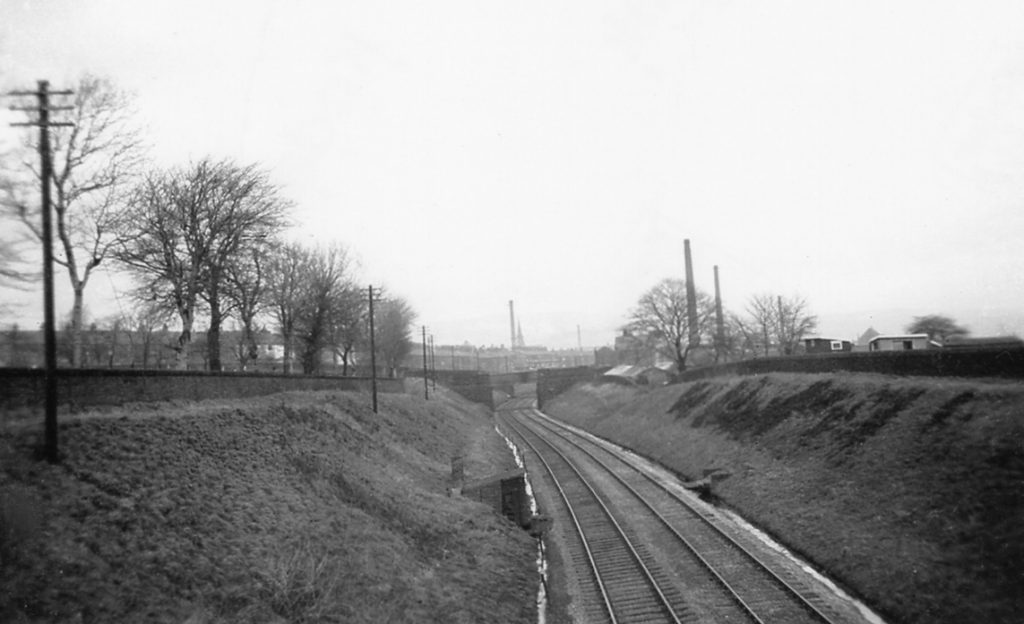
It closed to passengers in 1957, although freight trains still used the line after that. The station was demolished in 1965.
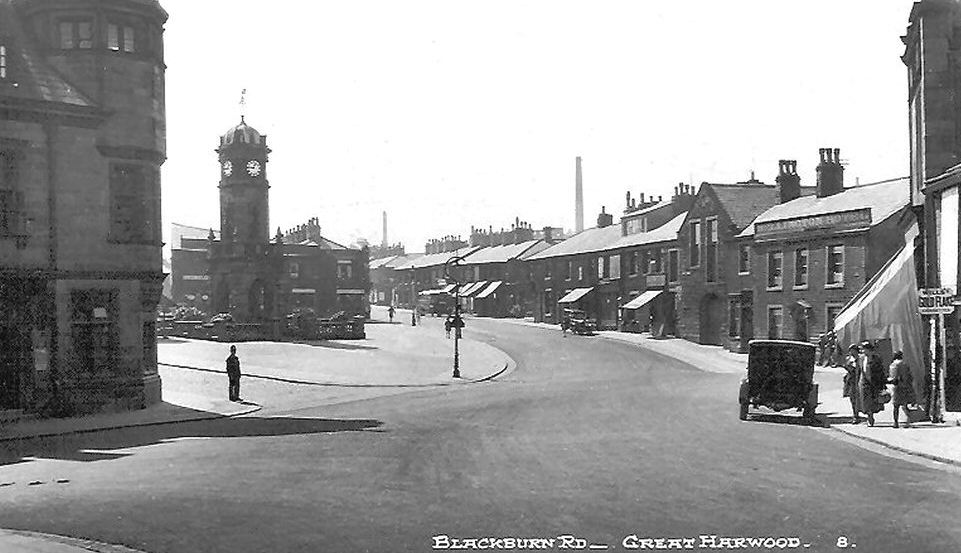
Returning to Town Gate to the south lies Blackburn Road, which we will explore next.
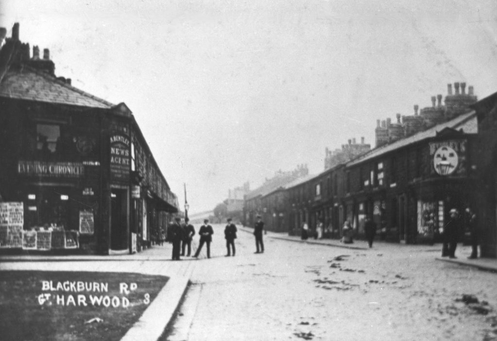
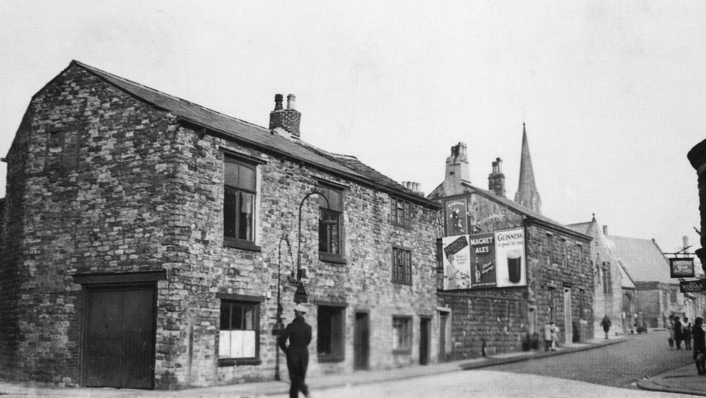
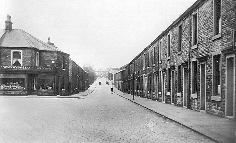
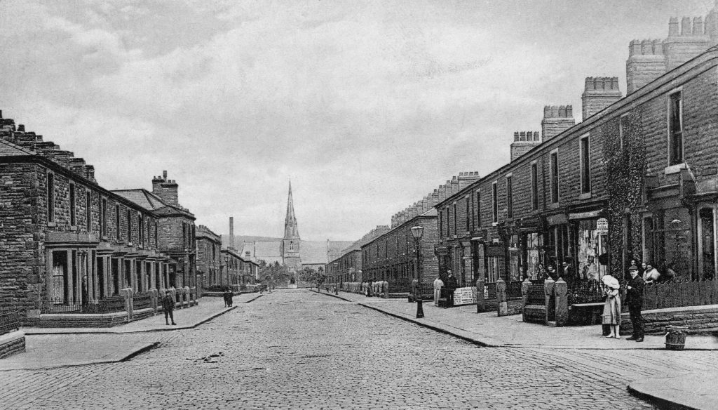
Blackburn Road, like Queen Street, had very few buildings until the town’s population increased substantially after the first power loom mills were built. In the late 18th century a cluster of houses grew up in an area known variously as Cross Gates, Stoney Greave or the Rood. It was an area to the east of Blackburn Road and north of Lomax Street. The oldest remaining buildings were built in 1780; these can easily be identified on the east of Blackburn Road with their rooflines being much lower than neighbouring buildings.
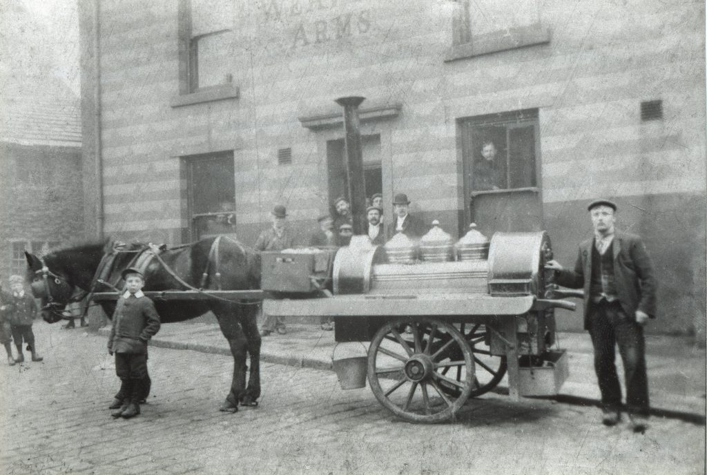
This photo shows a hot potato seller outside the Weavers’ Arms in the early twentieth century.The building didn’t become a public house until the 1860s; it was probably built in the early nineteenth century by the Bentley family who had leased Cockshott’s farm in 1754. The farm buildings covered most of the area where the Memorial Clock Tower now stands, and the farm lands included Stoney Greave and Cross Gates. James Bentley, grandson of the lessee of 1754, died here in 1834.
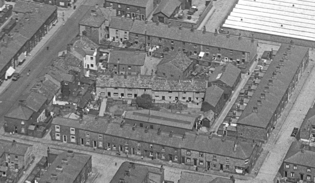
Enlarged from the aerial photograph of the 1930s, this photo shows the Rood and Weavers Arms. Six of the terraced houses on Lomax Street were the only houses on what was once called Cricket Street; the houses behind, known as Back Cricket Street, had by the time this photo was taken already been demolished.
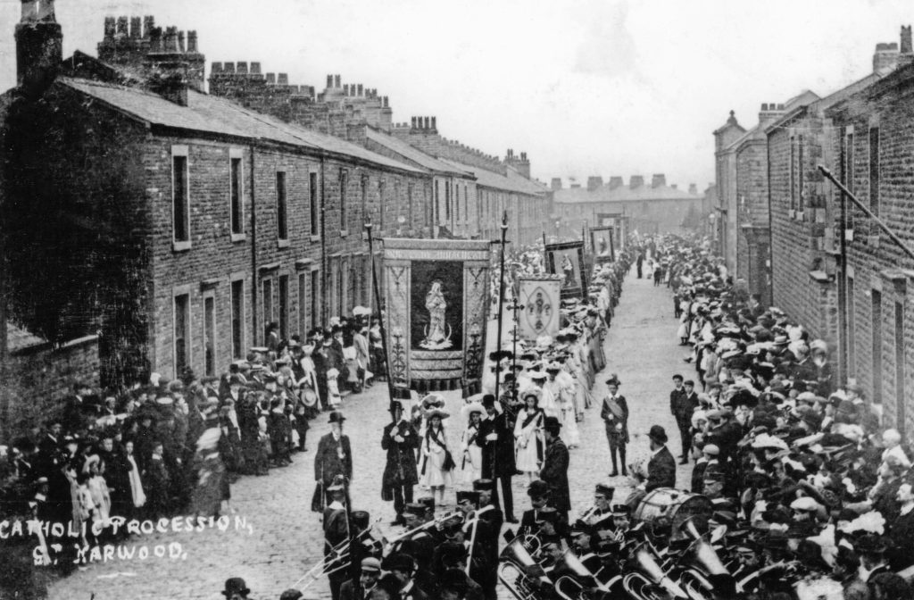
A Catholic Church procession on Lomax Street, early 20th century.Processions from churches were a regular feature of town life until the middle years of the 20th century – almost everyone turned out, either to take part or to watch.
Two views of Blackburn Road
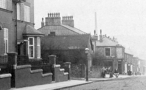
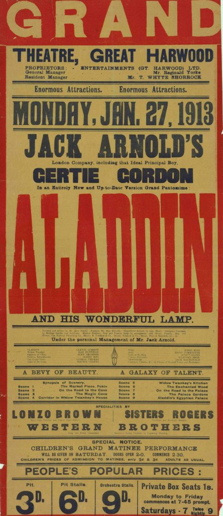
In the first photo the building shown between the former Police Station and the Lomax Arms was, between 1902 and 1910, Brunton’s Photographic Studio. The second photo shows the Grand Theatre. A theatre when it opened around 1910 it became a cinema in 1915 and operated until the 1970s.
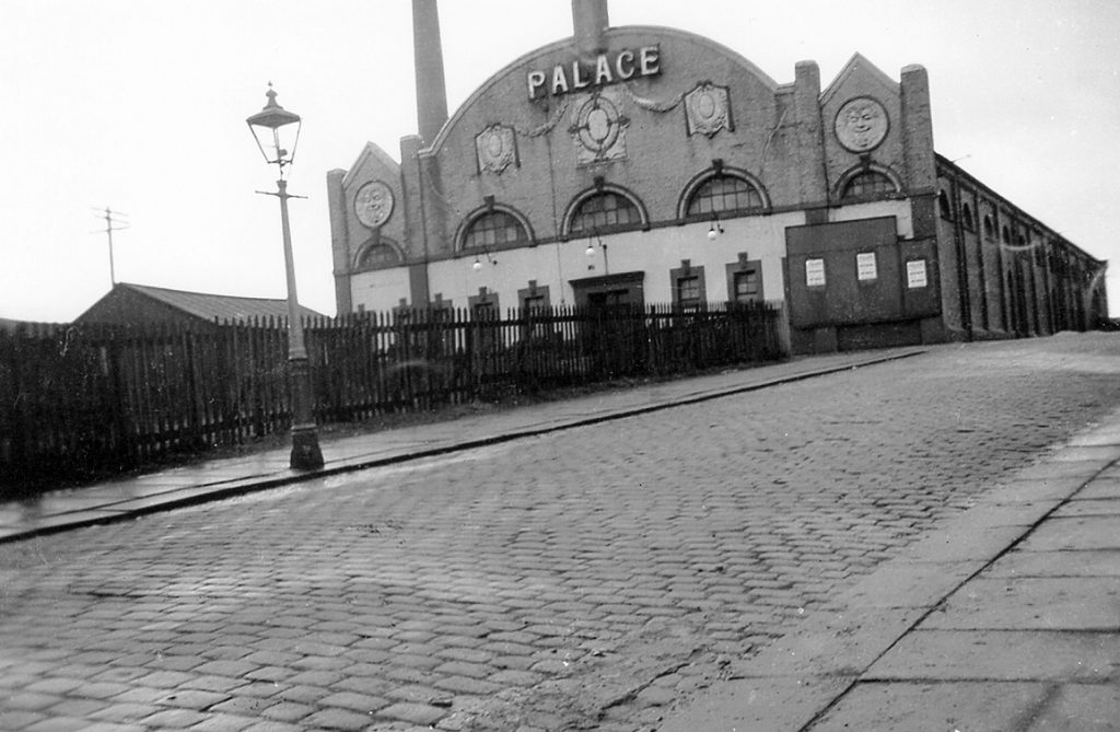
The Palace Cinema, Rushton Street. Starting life as a skating rink, later a snooker hall, it was known as the Rink Cinema until 1924 when the name was changed to the Palace.
The Police Station on Blackburn Road built 1905 to replace the station on Town Hall Street. Now converted to private homes.
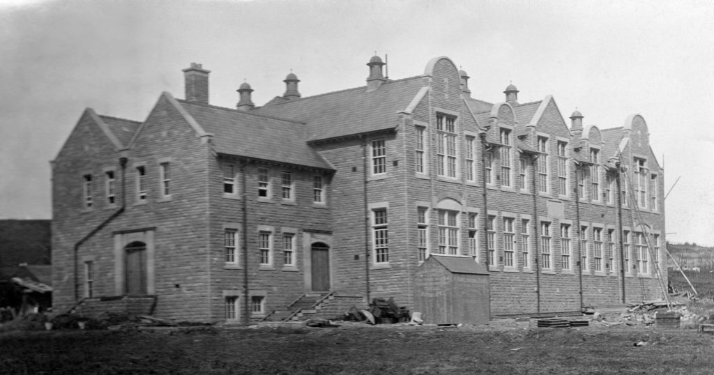
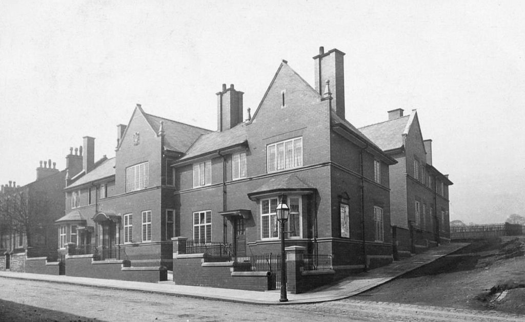
Western County School, Rushton Street. This shows the building almost completed in 1907.
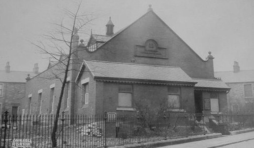
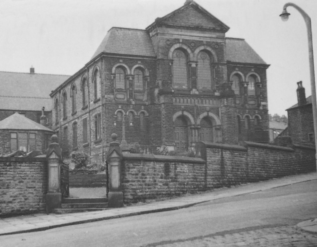
The James Barlow Baptist Chapel opened in 1903; it stood where the green space is now on Moss Street and Garden Street. It closed in 1969 and was demolished shortly after.
During the nineteenth and early twentieth centuries many small chapels of various denominations were built in the town. Most have either been demolished or put to another use.
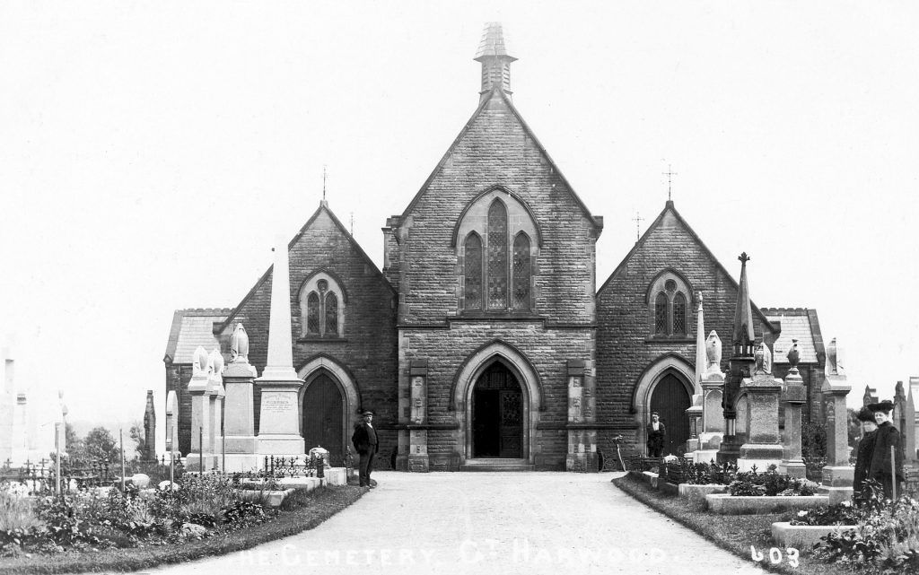
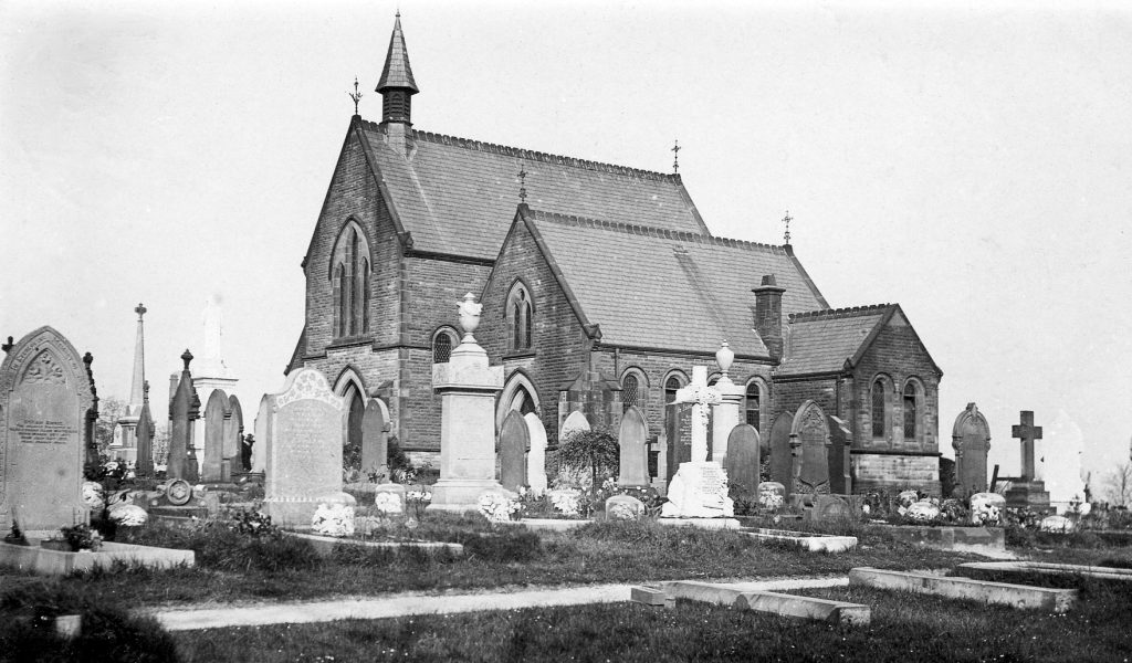
This was another type of chapel – the chapel in the cemetery on Blackburn Road. The cemetery opened in 1887 because the burial grounds at the town’s churches were now becoming overcrowded. The chapel, and cemetery, had provision for Anglican, Roman Catholic and Non-Conformist denominations. The chapel was demolished in 1994.
The cemetery on Blackburn Road was also becoming overcrowded by 1921 when land to the south of the cemetery, just over the lane, was bought from the Trappes-Lomax family. At one time this was the football ground.
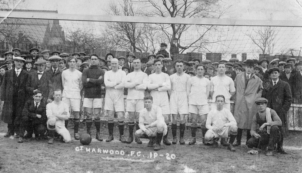
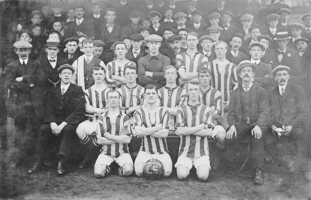
These teams played at the Lidgett Ground, as it was known.
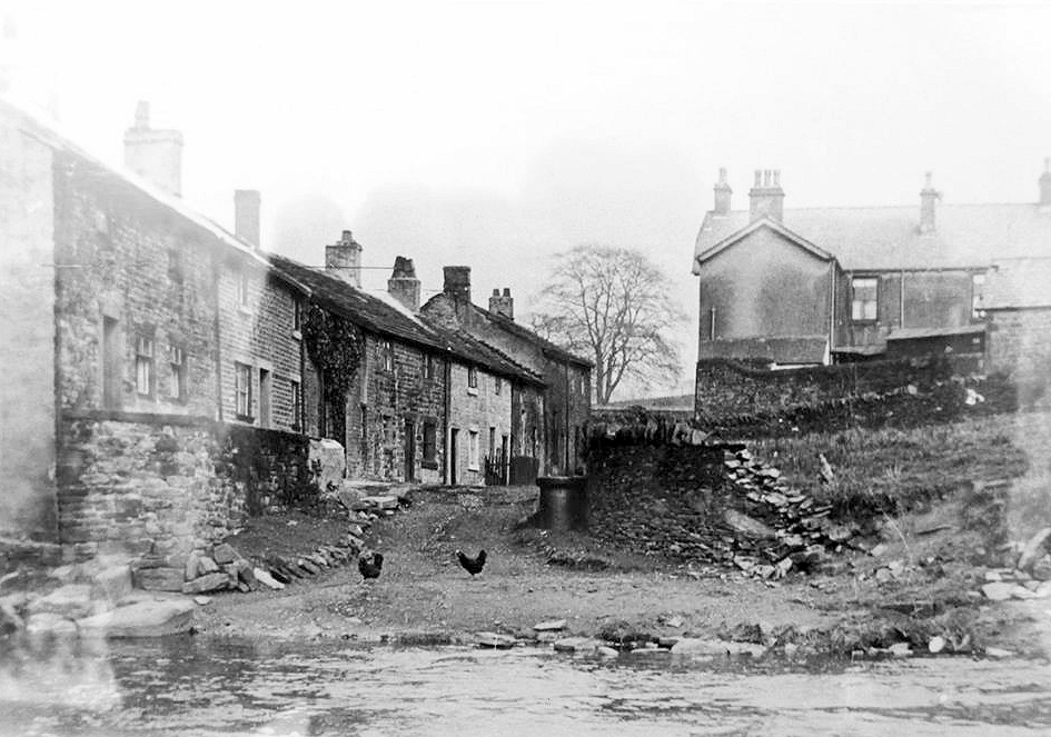
Lidgett. A plan of roads in Great Harwood made around 1800 shows ‘Lee Gate’, but the only building appears to be on the Rishton side of the brook. Entries are first recorded in the parish register at Lidgett in 1820.The Ordnance Survey map surveyed 1844 shows three blocks of houses, of which this was one. A map of 1929 shows the cottages named as Hawthorne Place.
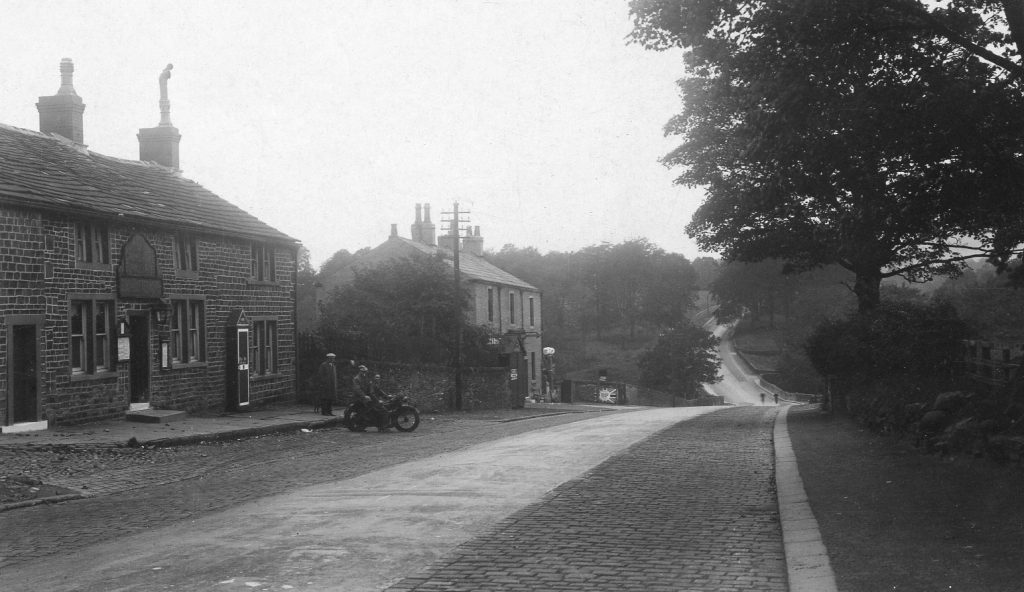
Returning again to the Town Gate we look west up Delph Road.
Delph Road was so named because it was the route to the quarries where much of the stone used to build the terraced housing in the town was extracted.
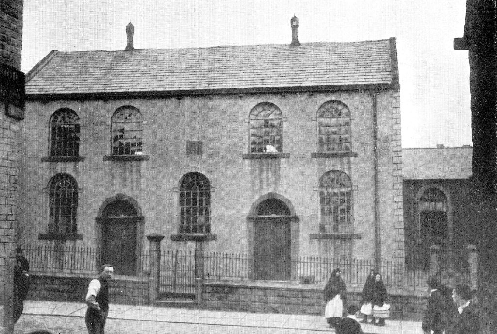
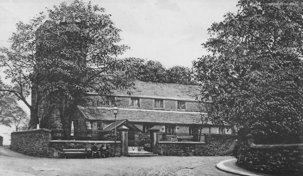
Two views of the Chapel at Butts. The chapel was built over a row of houses, named, not surprisingly, ‘Chapel Row’. John Mercer was instrumental in the building of the Chapel in 1822, which was a Methodist Chapel. The land the chapel was built on was formerly known as Jacky Croft.
There are two possible explanations for the name ‘Butts’; possibly land used for archery, but the most likely explanation here seems to be from the name for irregular shaped pieces of land at the end of common fields, which fits well here as the commons adjoined the lane.
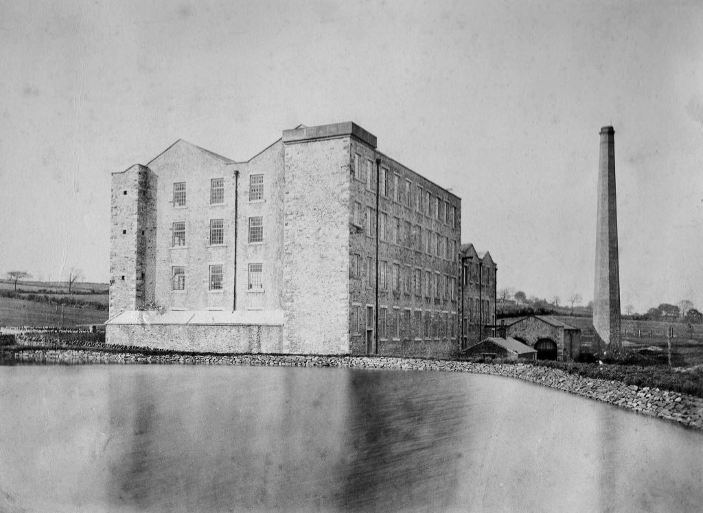
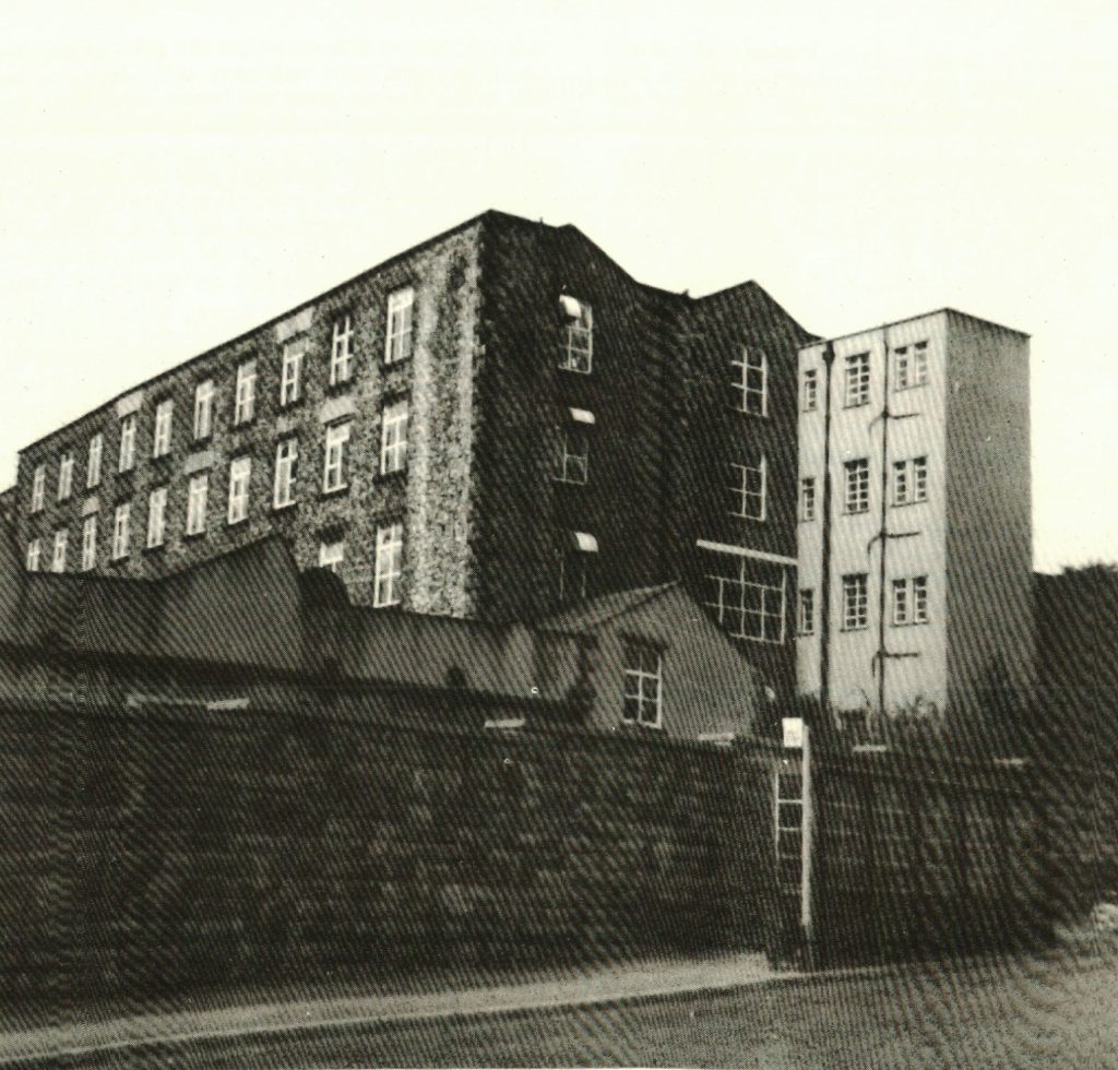
An early view of Butts Mill, or Delph Road Mill, from the mill lodge. Completed in 1865 it operated until 1968 and was demolished in 1972.
Detail from the aerial photograph from the 1930s, with Delph Road in the foreground. The landscape is dominated by Butts Mill. Also shown are Butts Chapel (bottom left) and Mount Zion Church to the right of the mill.
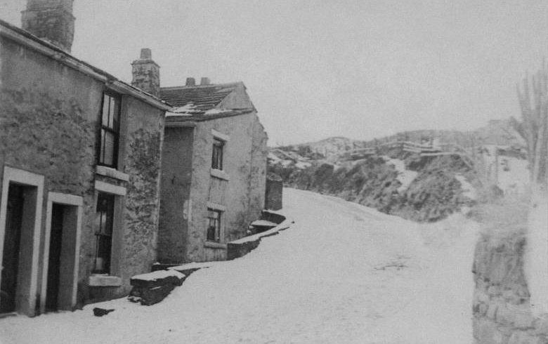
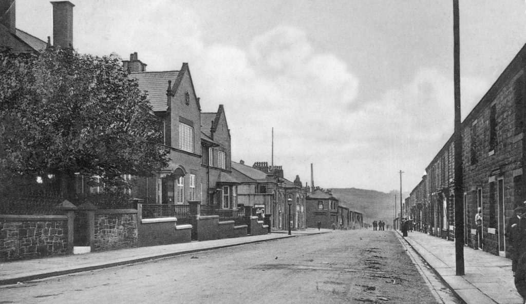
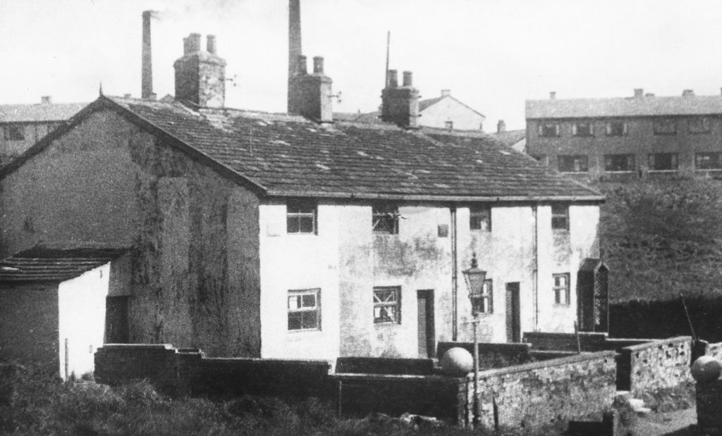
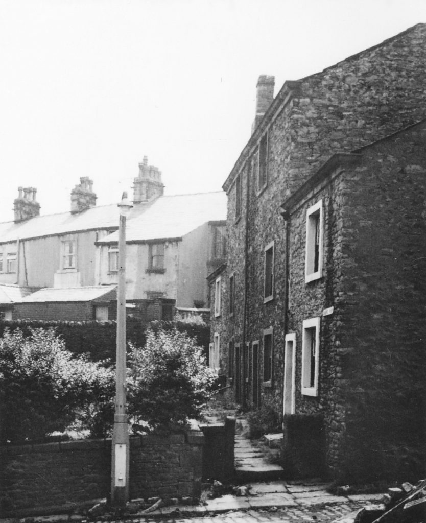
Continuing up Delph Road brings you to Edge End, which leads to Clinkham Lane.The cottages were built in the very early nineteenth century and were mostly inhabited by handloom weavers.
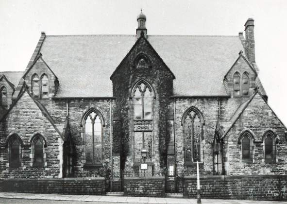
Down the hill from Edge End was the Central Methodist Church, King Street. Russell Place Church, founded in 1883, became Mount Zion Russell Place Methodist Church in 1956 after the chapel on Cattle Street closed, later uniting with Windsor Road Chapel. The church school buildings were converted to a church when the church shown in this photo was demolished in 1974.
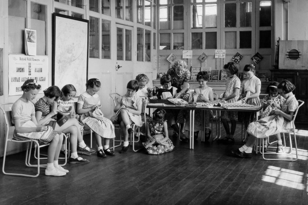
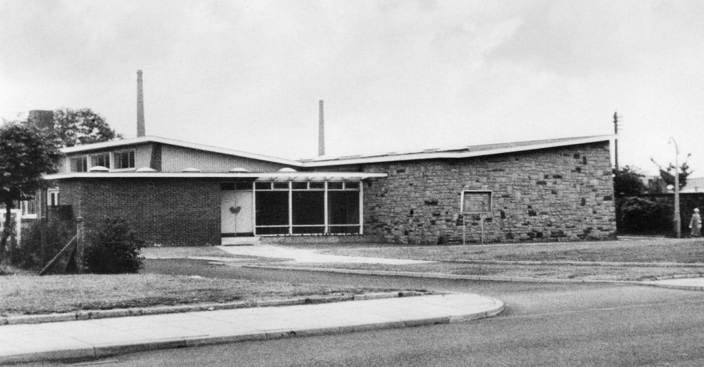
Western County Junior School, Commercial Road.This photograph, from about 1959, shows girls from the top two classes in a sewing lesson with Miss McVitie. At that time sewing and knitting was part of the curriculum for all girls at school.
Back to the Town Gate and now looking north up Church Street.
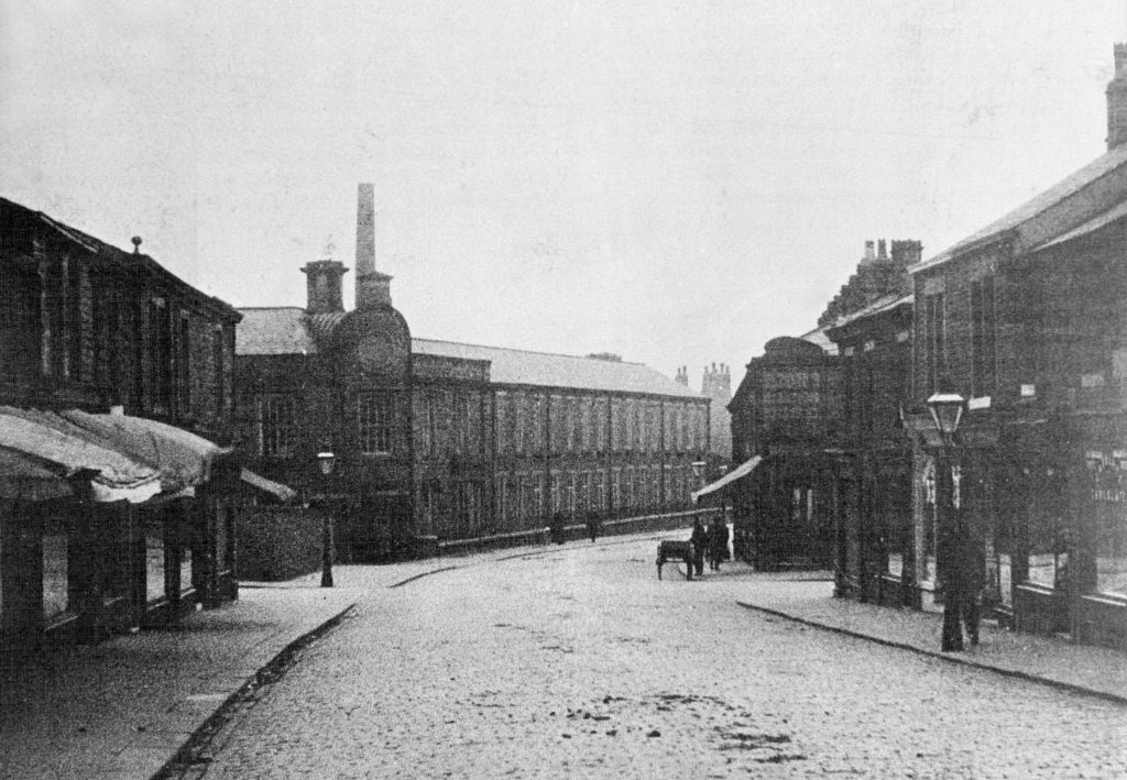
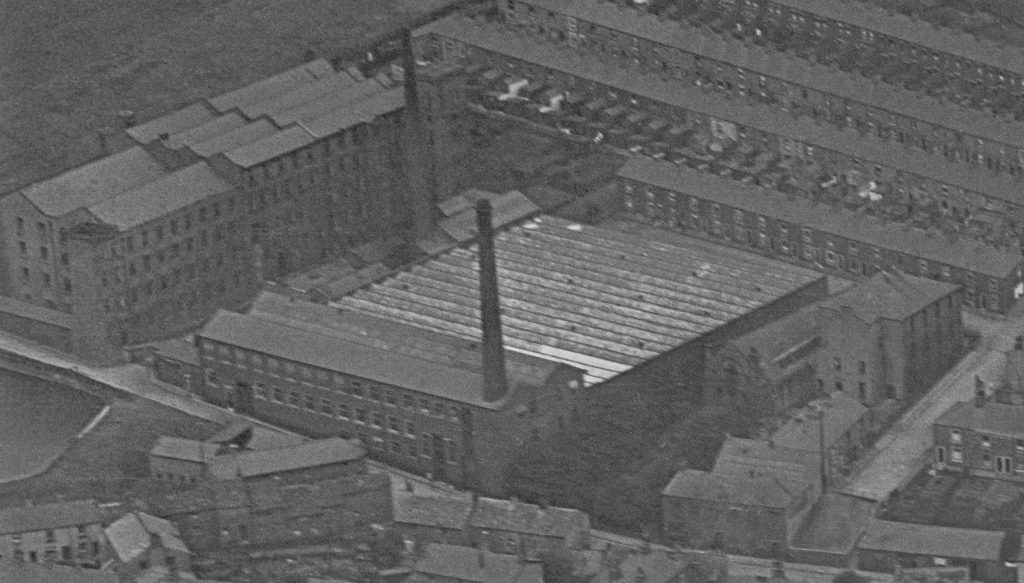
Bank Mill was situated on Church Street, and was the first power loom mill in the town. Built by Lawrence Catterall in 1844 it ceased operating in the 1960s.
Bank Mill viewed from Haydock Square on Church Street. Bank Mill House and a community centre now stand on the site.
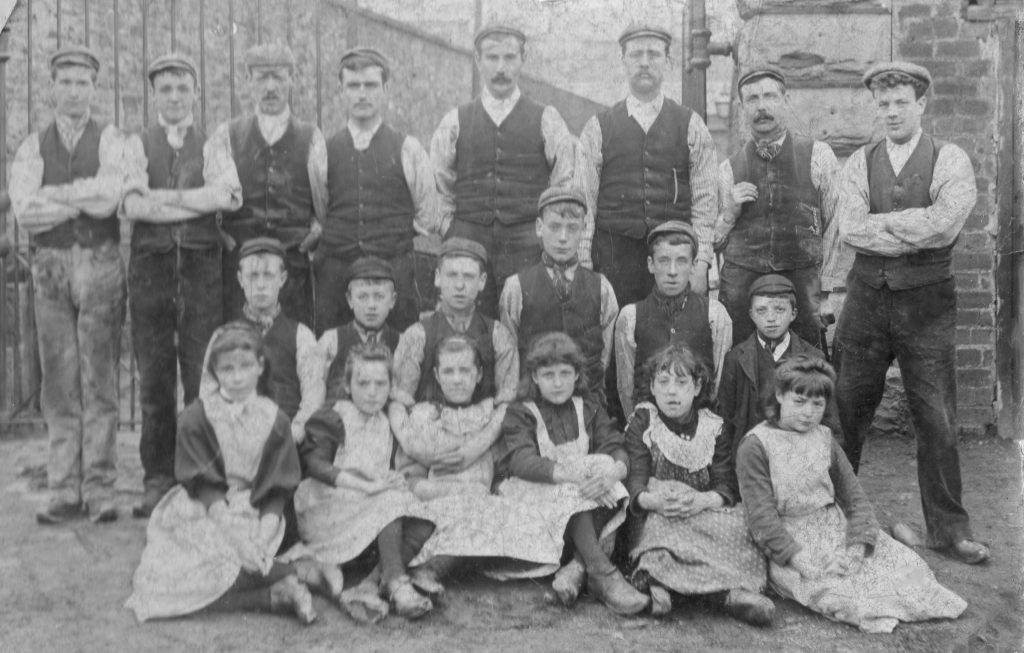
Workers at Bank Mill about 1900. At this time children could start work ‘half-time’ at the age of eleven.
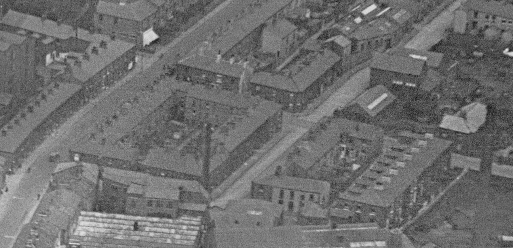
Detail from the aerial photo from the 1930s showing Church Street, with Bank Mill just visible, and houses fronting on to Mill Street, Britannia Street and St Lawrence Street. These houses have been replaced by the flats on Haydock Square.
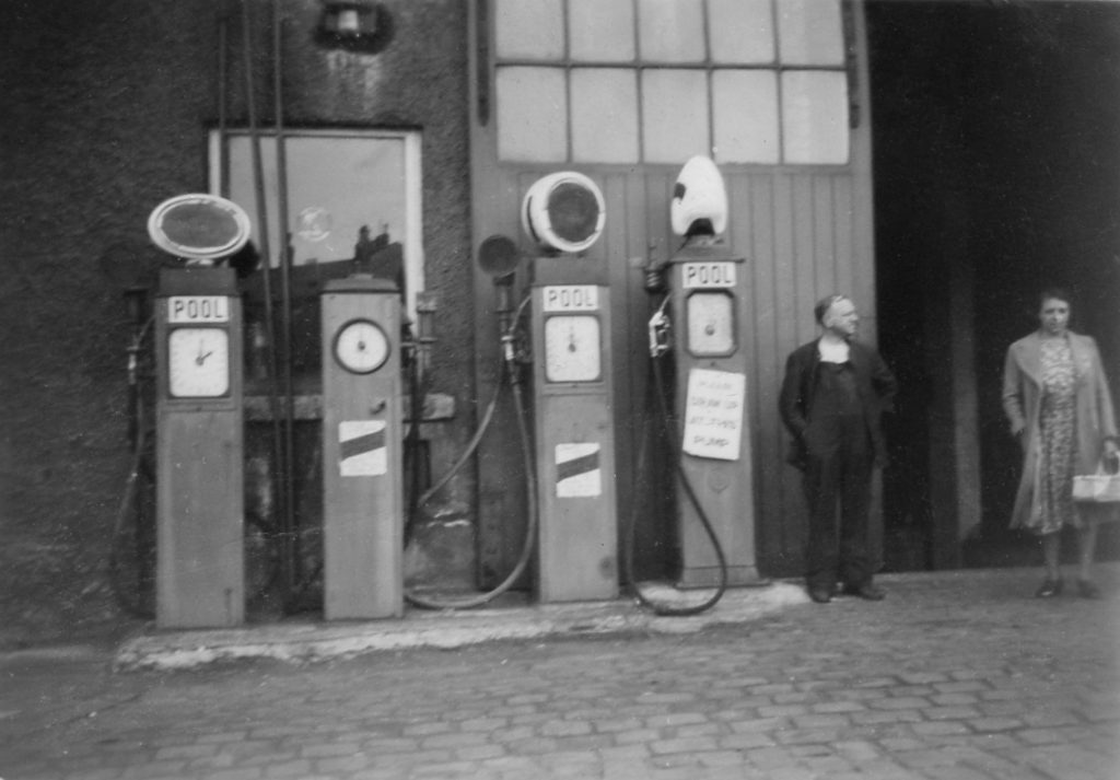
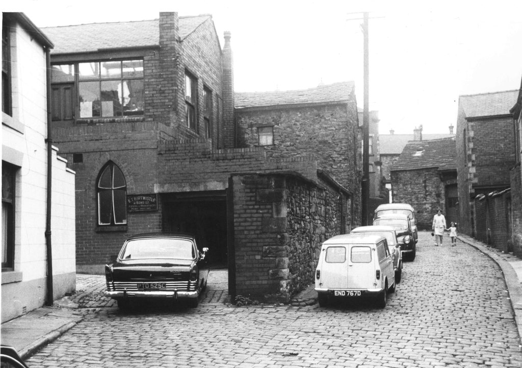
Robin Top Garage.This was on the site of the former Robin Top Mill on Mill Street, off Church Street.
With the outbreak of World War II petrol was the first commodity to be rationed. All the oil companies pooled their resources and no individual brands were sold, only ‘POOL’ petrol. Rationing ended in 1950, but POOL was still the only petrol sold until 1st February 1953 when branded products were again available.
Lowerfold Park was created on land donated by members of the Congregational Church in 1914.After WWII the park came under council control and the name was changed to Lowerfold Park.
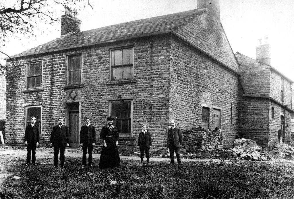
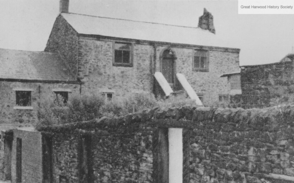
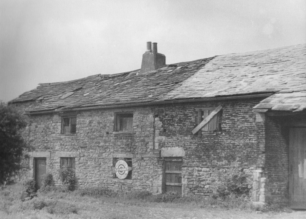
Lowerfold – perhaps one of the most ancient settlement sites in the town. The first documented mention is in the parish register of 1662 when Widow Mercer, wife of William Mercer of Lower Fould, was buried. This branch of the Mercer family were long associated with Lower Fold, the last member of the family being Martha Mercer buried in 1809.A plan of 1763 suggests there were six farms associated with Lower Fold.This photograph shows one of these farms, now demolished.
Children leaving the Parish School in the 1950s.
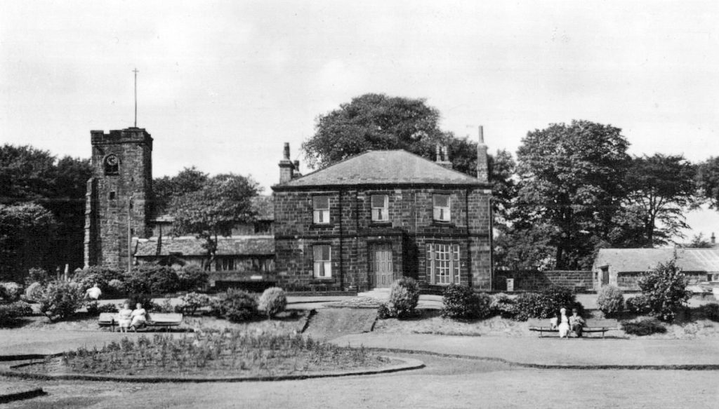
Churchfield House was built by surgeon Henry Ainsworth Grime in 1852, but sold to Joseph Haydock a few years later. The house passed to his son Milton, who, having no children, made provision in his will that after the death of his wife the house and gardens would be left to the town. Milton died in 1926 and his wife Janet in 1936, after which the house and gardens were maintained by caretakers. Rooms could be hired by local organisations and a there was a reading room.
In 2013 the running of the house was taken over by the Churchfield House Trust, made up of members of the Civic Society. The house now has rooms that can be hired for events and it also opens as a tea room.
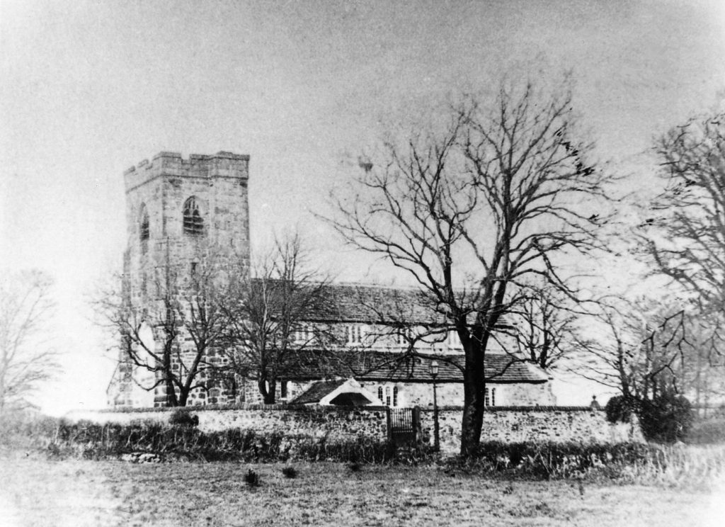
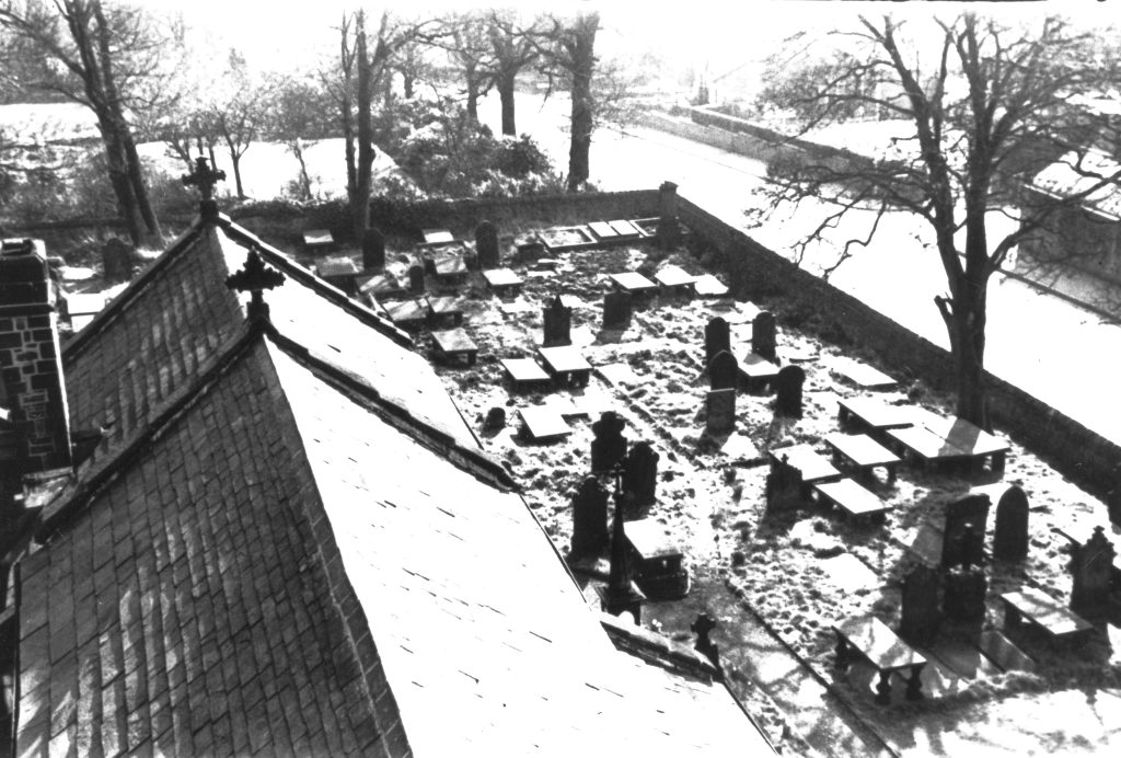
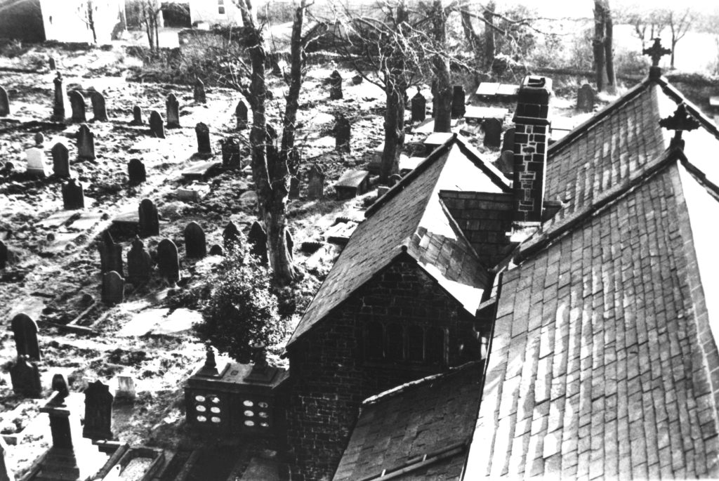
An early photo of St Bartholomew’s Parish Church.
Originally a chapel of ease for the mother church of St. Mary the Virgin in Blackburn, and known as St Lawrence’s until the mid 19th century, the parish church was first mentioned in a document in 1335. The oldest parts of the church are the fifteenth century tower and the aisles and nave, which are sixteenth century. It became a parish church in its own right in the nineteenth century.
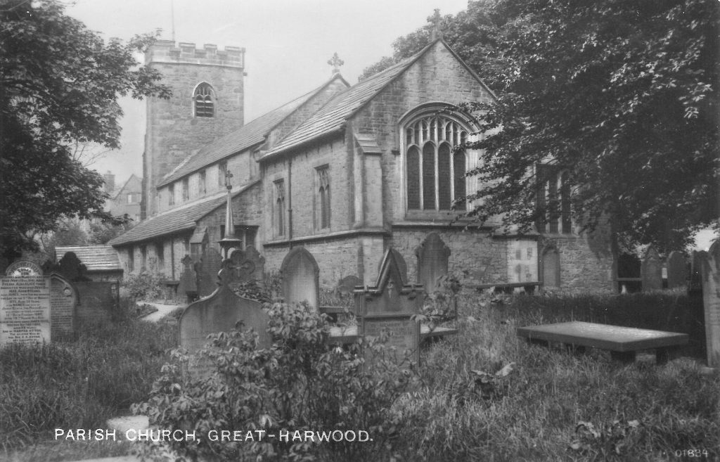
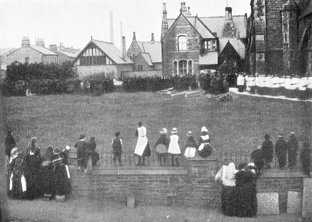
In the 1970s it was decided that many of the gravestones posed a safety risk; most were removed, with some being retained as paths around the church. Some of the larger monuments were left in situ.
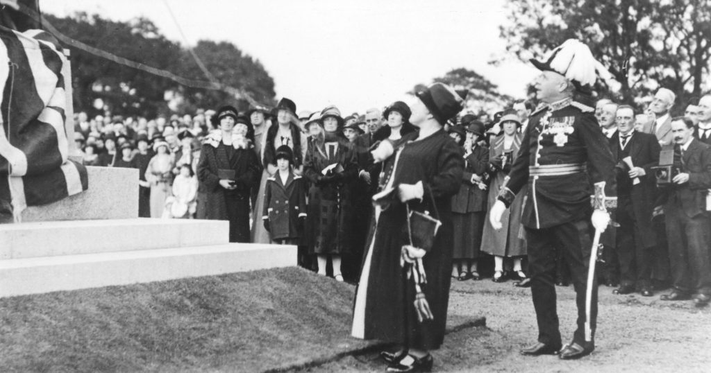
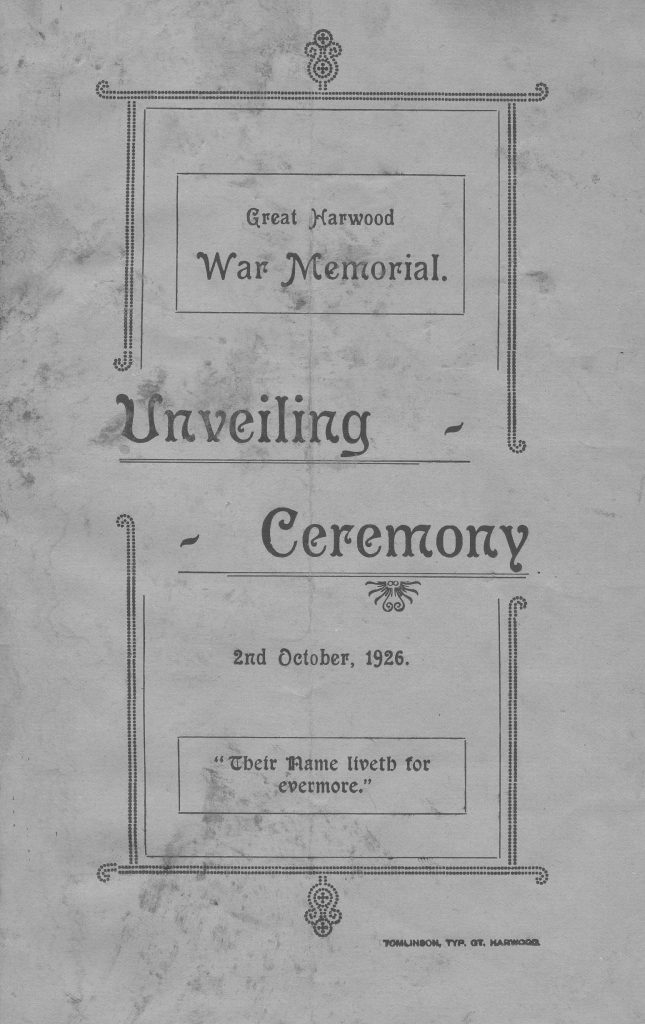
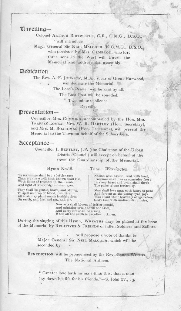
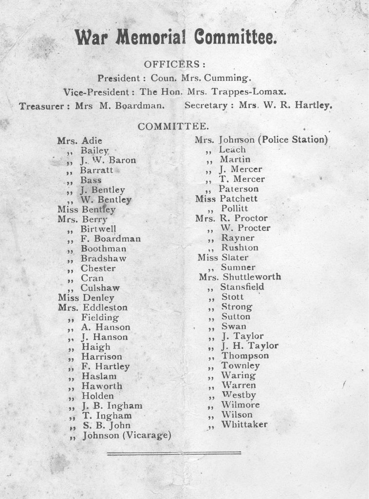
After WWI a memorial to the fallen was proposed, but it was not until 1926 that it came into being when a committee of women achieved the aim.The monument was unveiled by Major General Sir Neill Malcom and Mrs Catherine Ormerod, who lost three sons in the war.
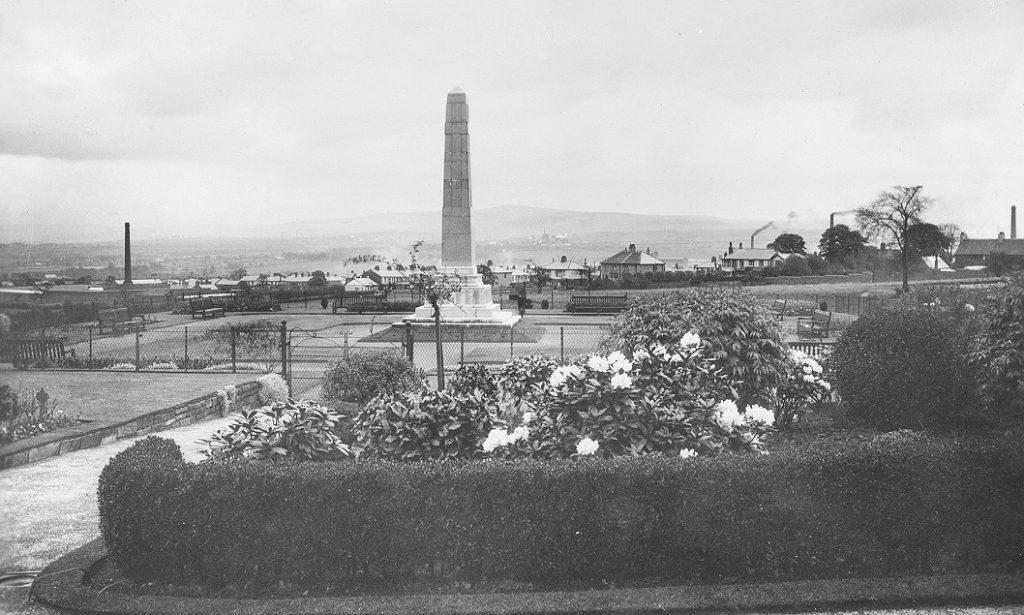
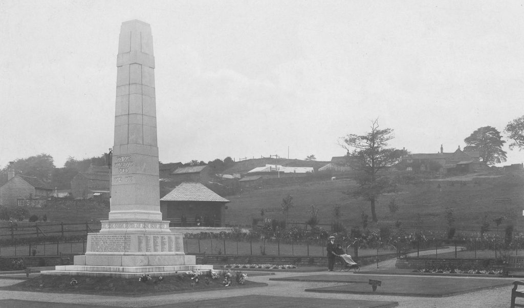
Readers of a certain age will have fond memories of War Memorial Park. On sunny weekends it was full of families enjoying the extensive lawned areas – and the ‘budgie hut’, pictured left behind the monument, was a certain attraction for the children.
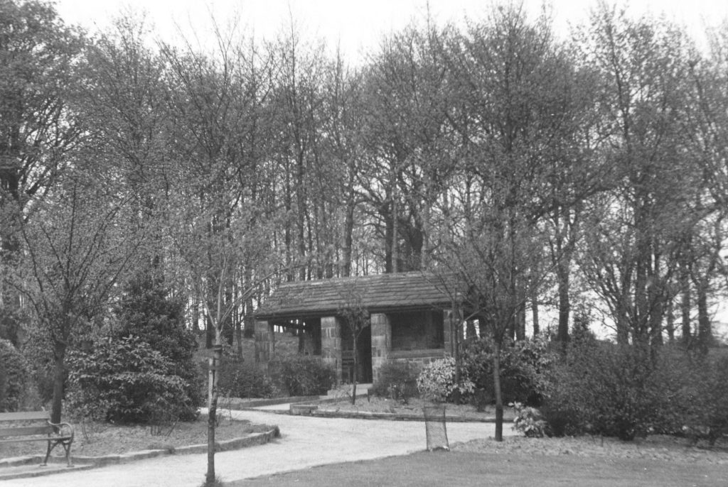
This was the summer house, set just in the woods at the park. Pop and crisps could be bought here, and clubs and balls for the putting green hired.
St Hubert’s Roman Catholic Church seen from St Hubert’s Road, which was laid out to frame the view of the church.
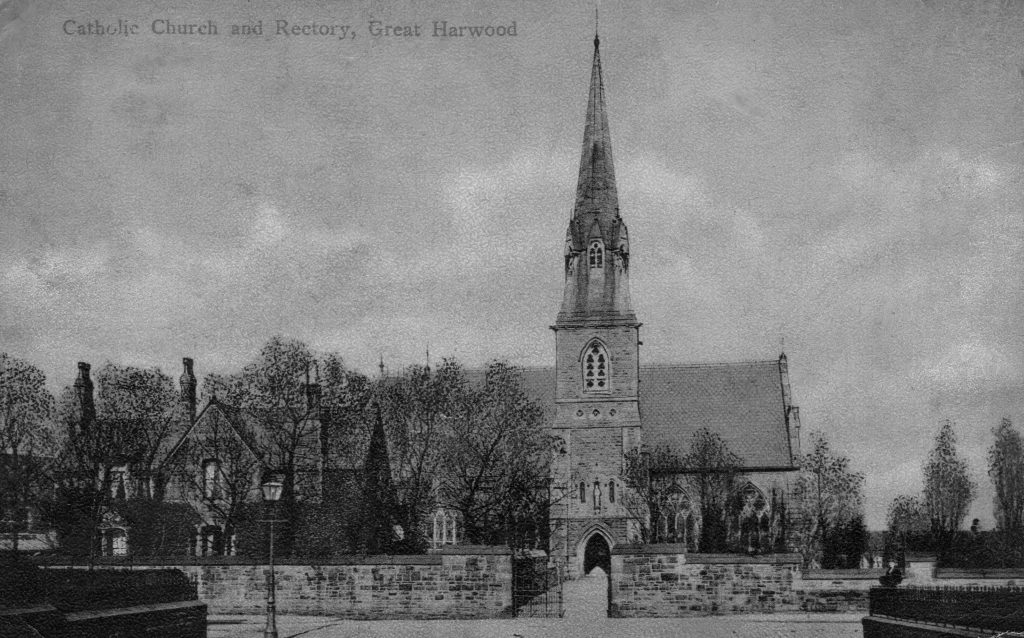
St Hubert’s Church was erected by James Lomax in 1859 to cater for the growing Catholic community in the town.The photo to the left was taken in 1887 – the funeral of Father Richard Dunderdale.
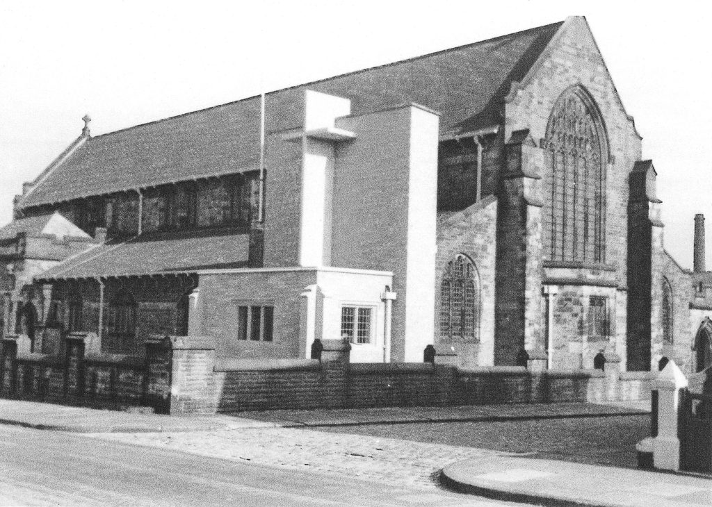
St John’s Church. The first building on the site was an iron church opened in 1898 as a chapel of ease for St Bartholomew’s church. It was replaced by the building pictured here in 1912. Closed in 2006 it was demolished in 2009.
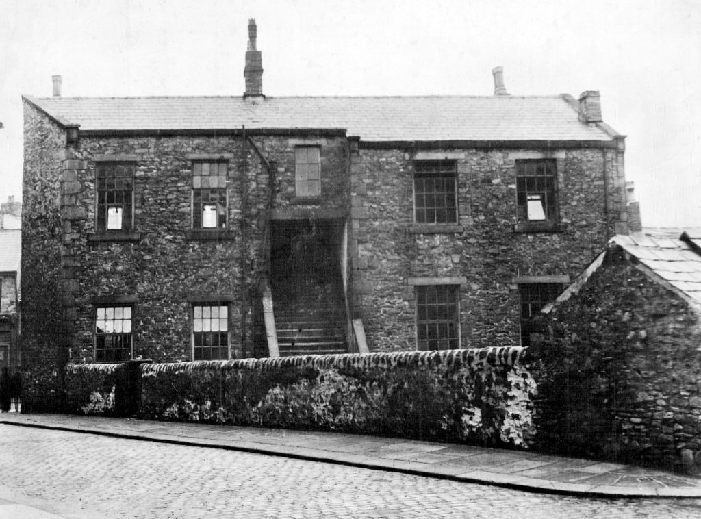
Martholme, at the end of Martholme Lane and near to the Calder, was formerly the manor house of the Heskeths, lords of the manor for two thirds of Great Harwood. Their main residence was at Rufford, and Martholme was often let as a farm.The Turner family, later of Blackburn and Helmshore, textile manufacturers, were first mentioned as being at Martholme in 1681 and resided there until about 1800.
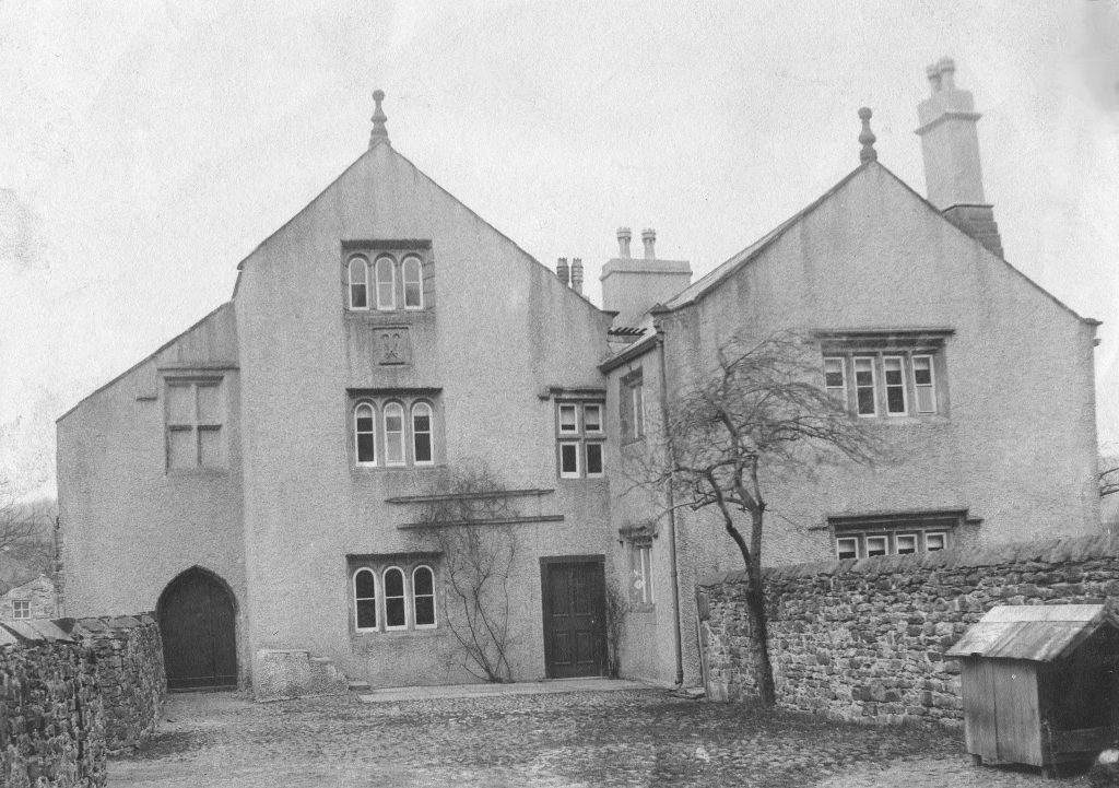
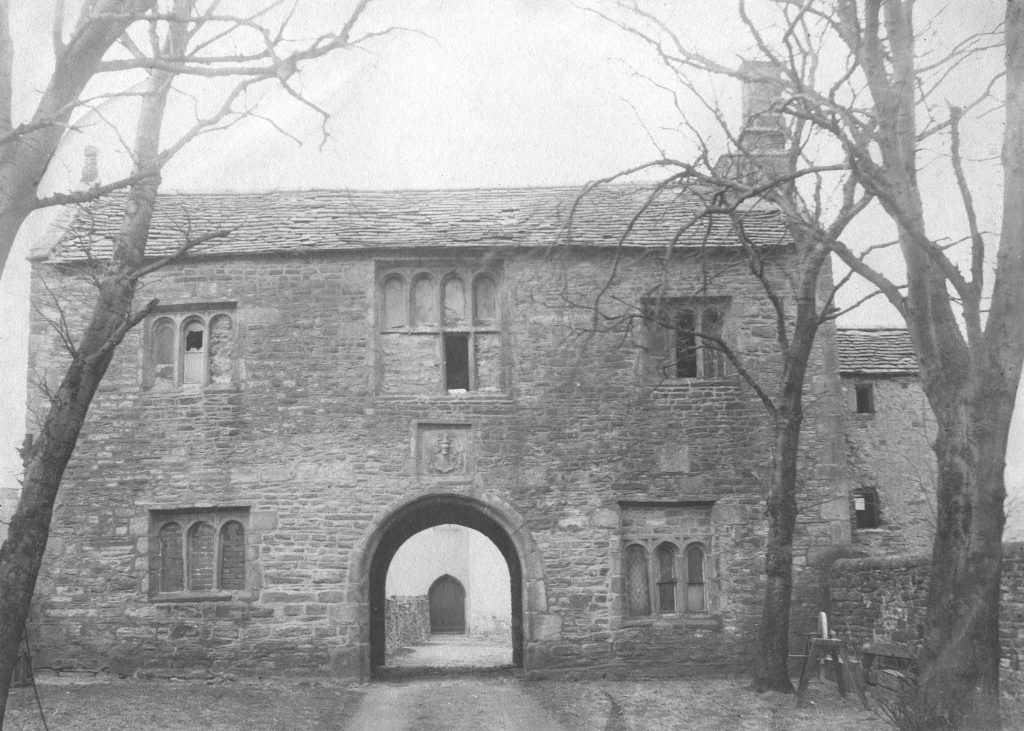
Below is the gatehouse at Martholme, dating from 1561.The house, pictured above, is thought to have had a medieval hall, possibly lost around the time of the English Civil War. There are the remains of a moat surrounding the site.
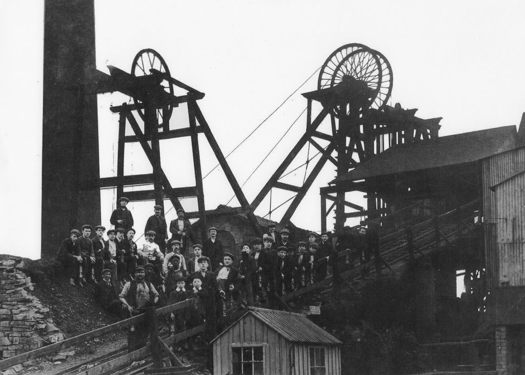
Documents exist from the mid 1500s and early 1600s where access to ‘coal pits’ through Great Harwood land is requested, but it isn’t certain these pits were in Great Harwood. A Hesketh document from 1643/44 however, specifically mentions a coal mine at Martholme.Over time coal was extracted at various sites in the town, but Martholme Pit, pictured here, was opened in 1864. It closed in 1921.
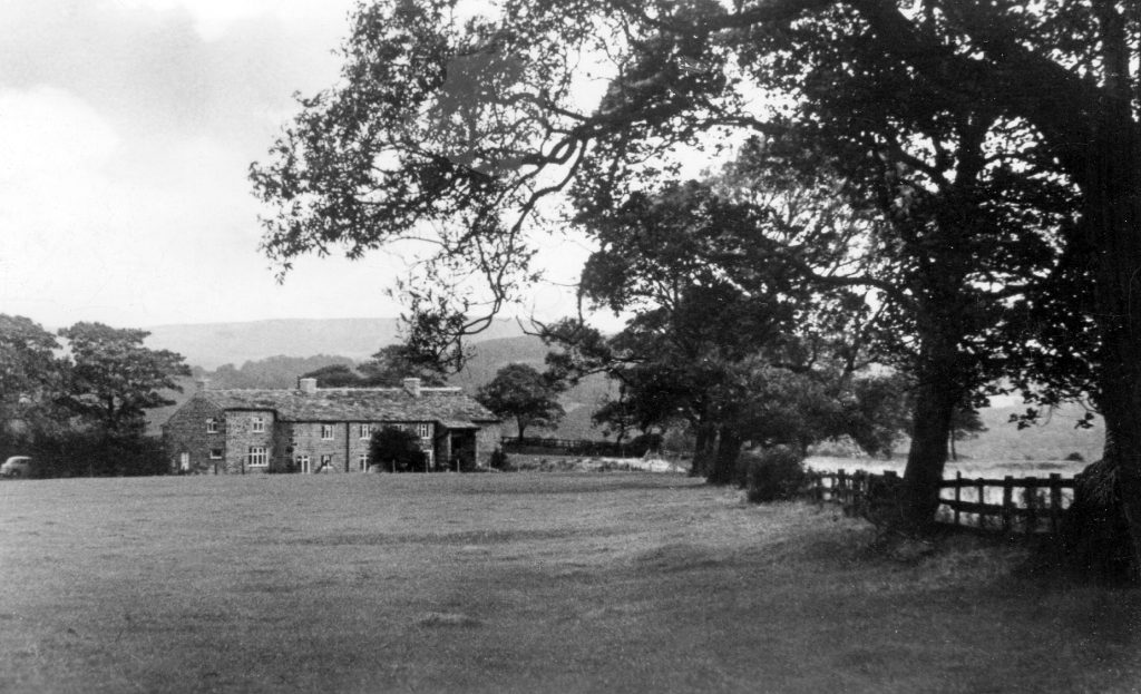
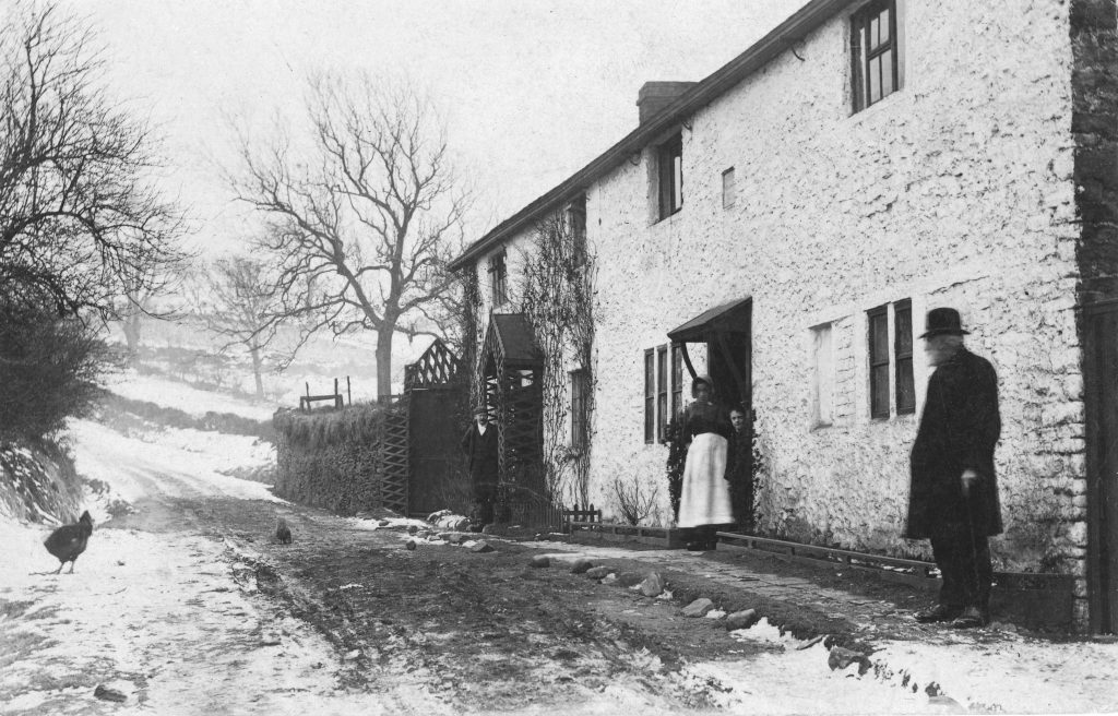
Stoops stood close to the main highway through the town, which originally ran along the line of trees on the right of this photograph. When the turnpike was built this bend in the road was straightened and the road now runs to the left of the house.The grandfather of John Mercer the Chemist, Thomas Mercer, farmed at Stoops.
In the 1947, after standing almost derelict for some years, the house was bought by the Lancashire author Joan Pomfret and her husband Douglas Townsend and extensively renovated.
Cop Hall cottages, now Checco’s Italian Restaurant. It is likely these cottages were built around 1803 when John Aldred leased part of his housefield at Stoops to a Lawrence Sharples. Aldred sold both Stoops and the cottages to Lomax in 1817.
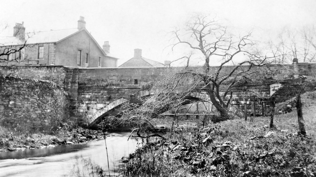
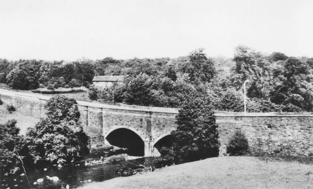
Hyndburn Bridge, with the public house showing on the left of the photograph. When the bridge was rebuilt in 1929 remains of an ancient saddle bridge were found incorporated into the fabric of the bridge, showing that there would have been a bridge here for many years.
This lovely view is of the ford across the Hyndburn, with Water Street in Clayton le Moors showing on the opposite bank.
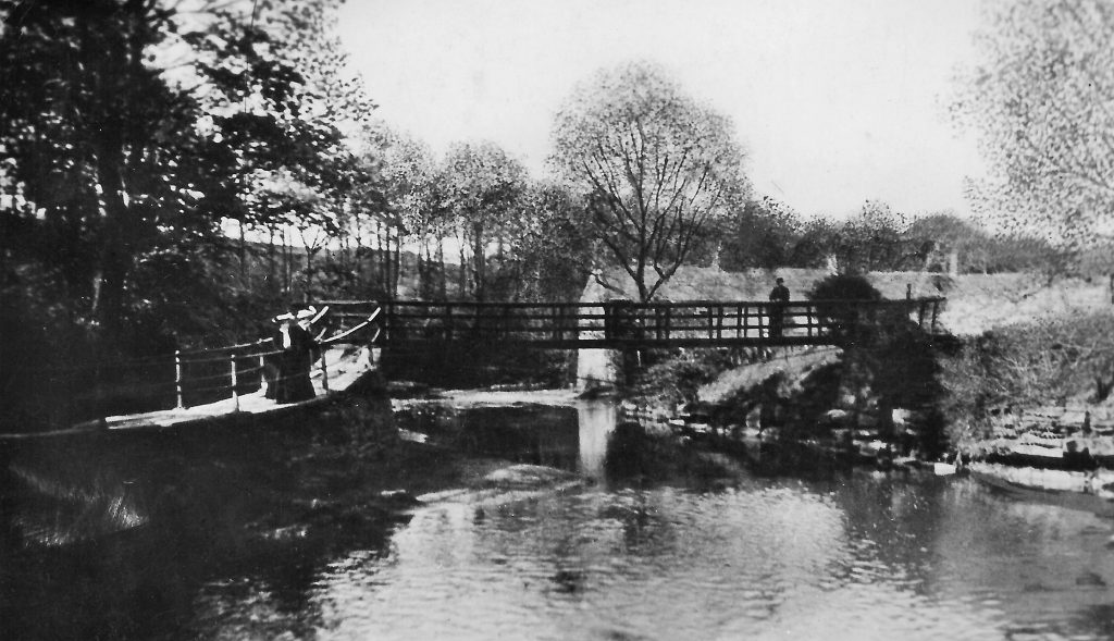
This was the route of a pleasant walk on a fine day – the ‘Red Bridge’ over the Hyndburn near to the ancient ford.
Officially called Norden Valley, this area was either known to locals as Clayton Fields or Harwood Fields – depending on which side of the boundary you lived.Oddly, those from Harwood referred to them as Clayton Fields and those from Clayton as Harwood Fields.
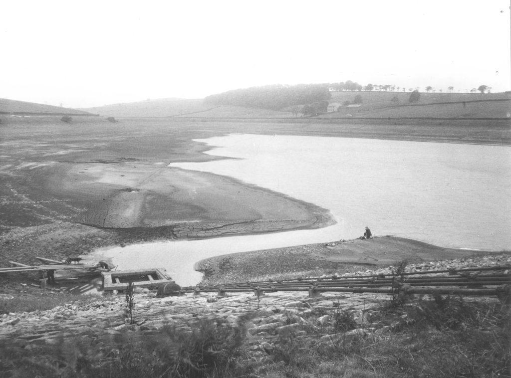
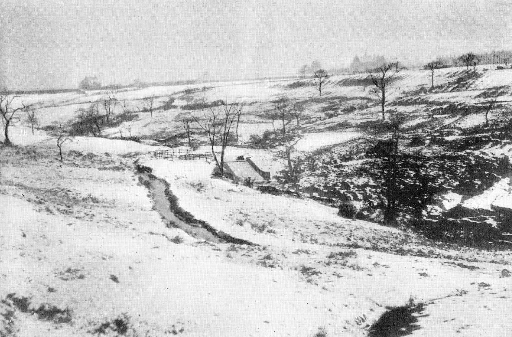
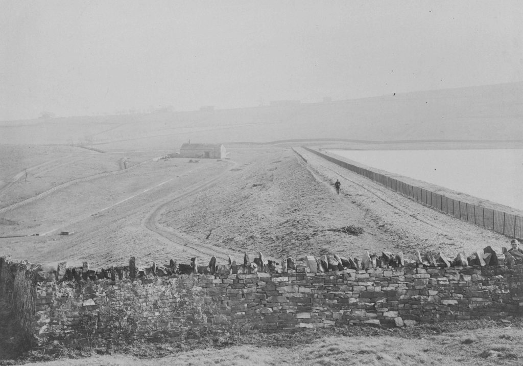
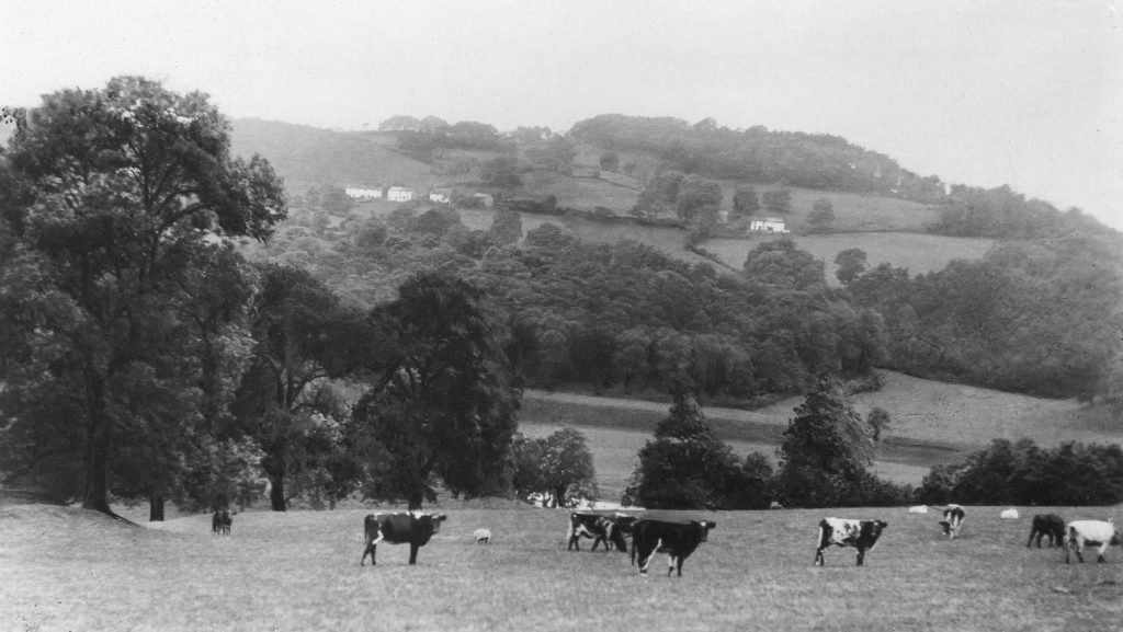
Dean Reservoir built in 1870. This photograph was taken in a year of drought, 1934. The area was mostly moor land held in common until the mid-eighteenth century when it was enclosed and leased to local farmers.
Many of the farms in the Dean area were built during the eighteenth century when common lands were enclosed, but some are recorded before then. Riley Hey, which can just be seen across the reservoir in the photograph above was recorded in the parish register in 1666. Smalley Thorn, in the foreground in the photo below, also existed before the eighteenth century enclosures; in 1692 the parish registers records that Margaret, wife of John Smalley of Smalley Thorn was buried.
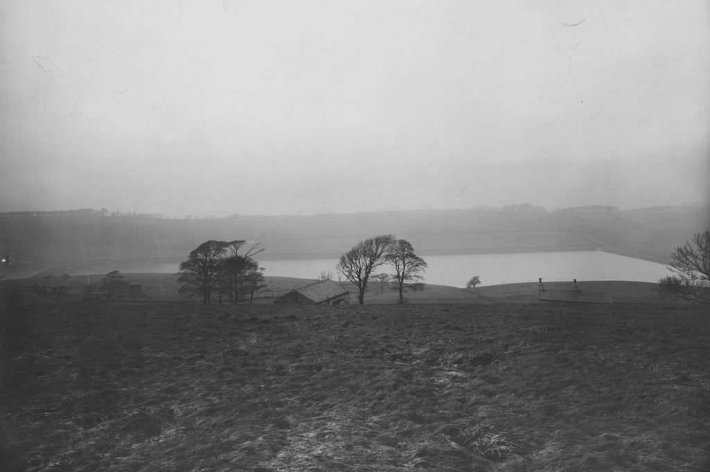
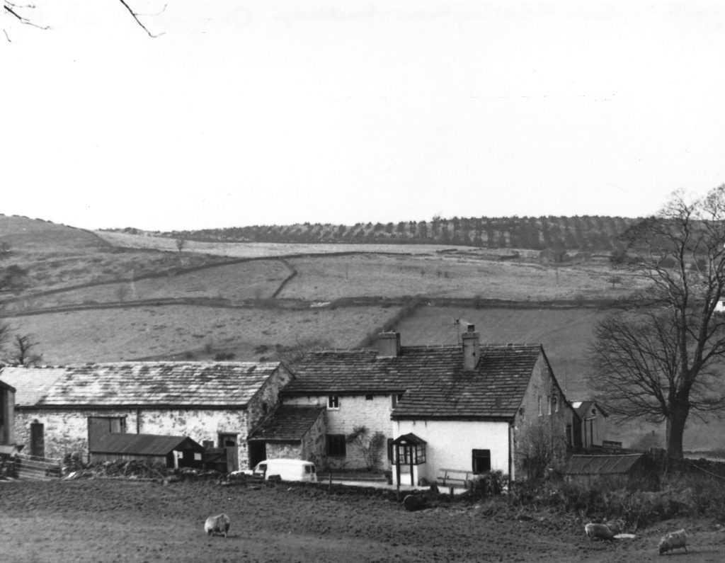
Smithy Cote, sometimes just recorded as Cote in documents, was another dwelling dating from before enclosure. Most of the farms close to the reservoir have now gone, with Bradley Hall farm alone remaining.
A survey of Hesketh land made in 1735 shows Simon Haydock was the tenant at ‘Bolton’s’, this was what later became known as Back of Bowley farm. William Bolton of Bowley was buried in 1699. He was a shoemaker, and also a Catholic recusant.
Back of Bowley cottages. On the near cottage a date stone says ‘Jas and Esther Whittaker 1805’. Probably built around the same time, the further cottage was owned by Edward Mercer.
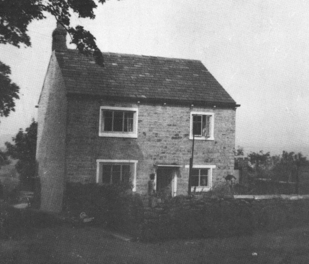
This cottage, on the east side of Dean Lane at Back of Bowley, was built by Thomas Mercer, second husband of the mother of John Mercer the chemist. John Mercer’s mother and stepfather both died in 1810, and Thomas Mercer left the house in trust to Joseph Clayton, his wife’s brother, until their son William, half brother to John Mercer, should reach twenty one. John Mercer wove at the house with his Clayton uncles, who lived nearby in houses now long gone.
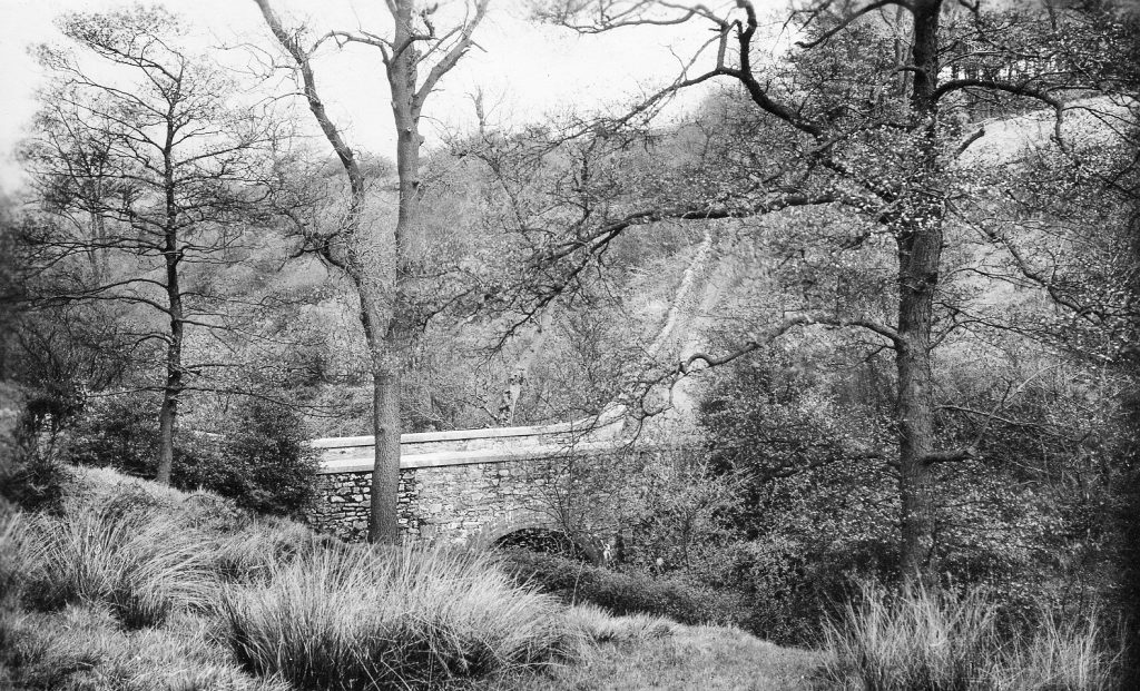
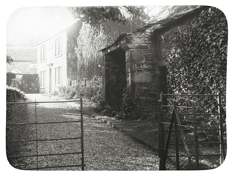
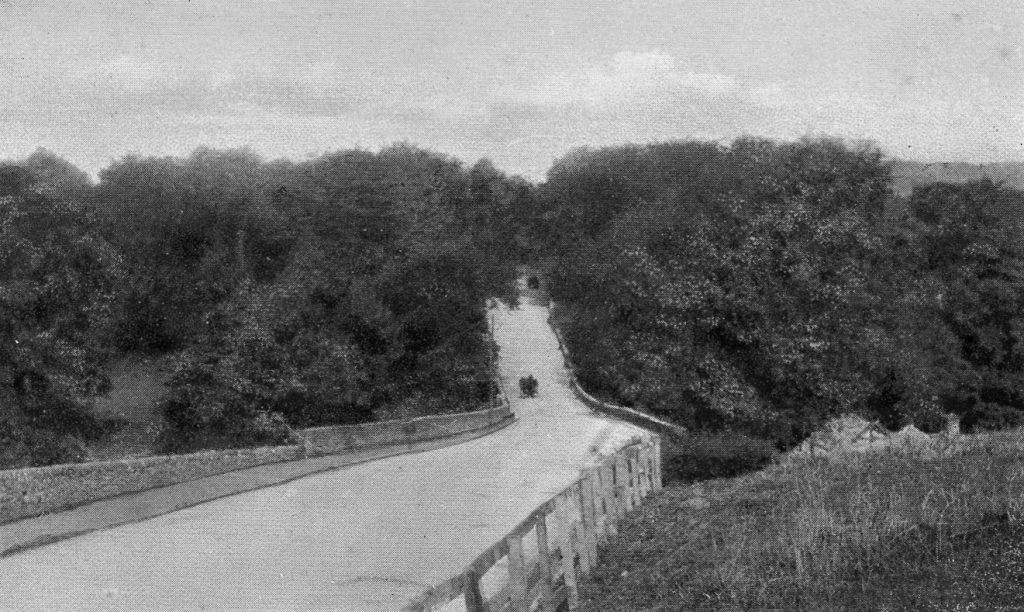
Dean Bridge. A lovely walk, particularly in spring when the bluebells are in bloom. At one time this was a well used route from Great Harwood to Whalley across the Nab.
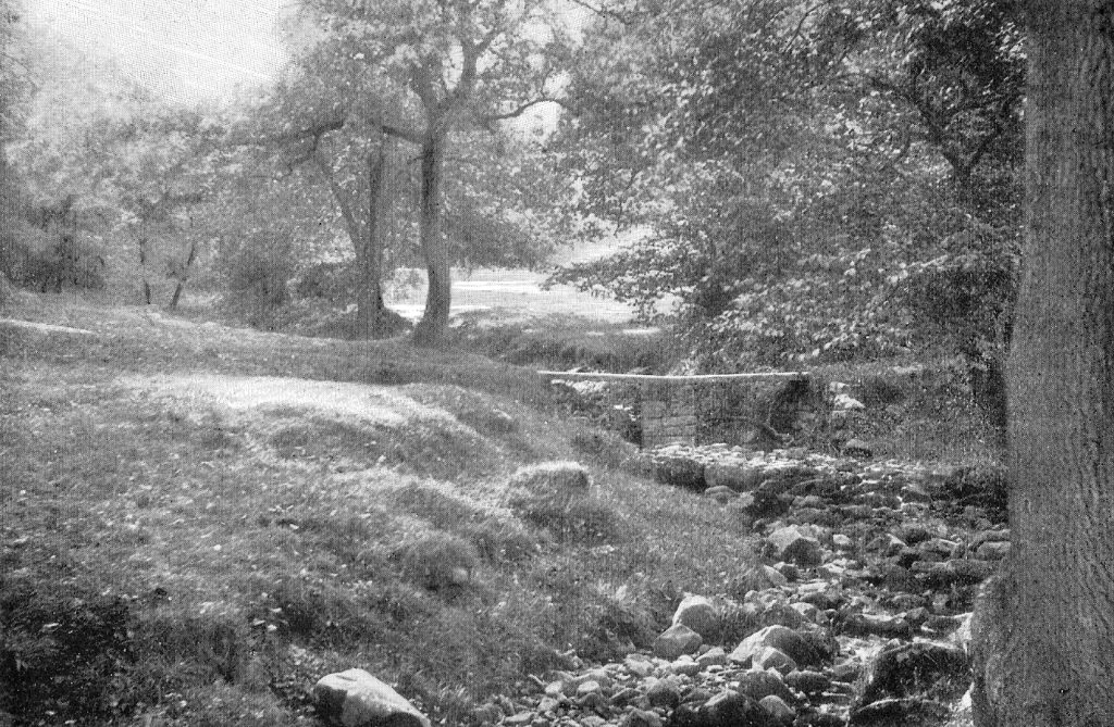
Waterside, showing the clapper bridge. Now a well known beauty spot, there was a farm near to here from at least the early 1700s.
A view of Whalley Nab.
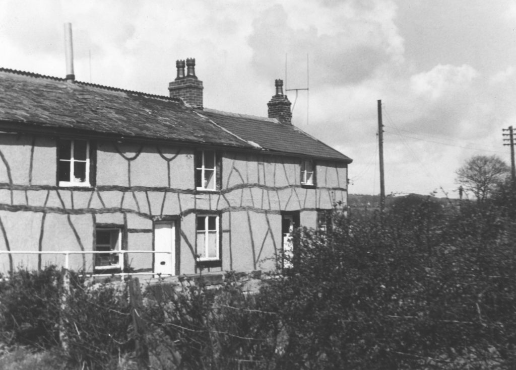
Tan House was leased by a branch of the Mercer family at least since 1670, and quite probably before then. There are two buildings that were known as Tan House next to each other – the one that can just be seen in the background of this photograph fronts onto Tan House Lane. The association of the Mercer family with Tan House ended shortly before 1841; in the census taken that year the family of James Birtwistle, joiner, is listed there.
The house now known as Tan Cottage on Tan House Lane was leased by Richard Walmsley in the eighteenth century, and it is possible it was the continuation of a lease held by his father William Walmsley. After the death of Richard the house passed to his nephew Thomas Taylor. Thomas Taylor of Tan House died in 1804.
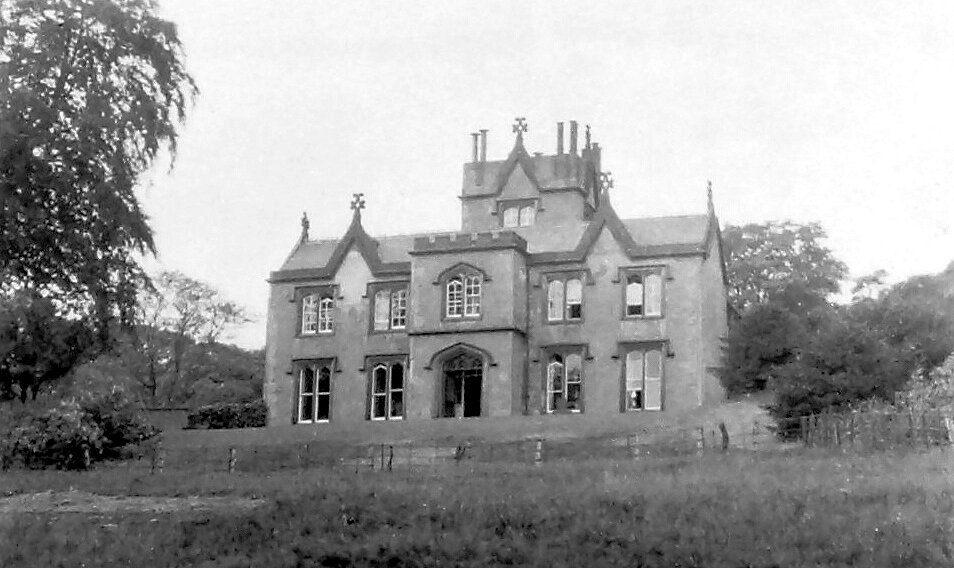
Alsprings was built by James Lomax in 1838 on land given to him by his father. He lived there until his older brother died and he inherited the Clayton Hall Estate, which included lands in Great Harwood, and moved to Clayton Hall.The house was let out until after the death of James in 1886, when his widow Frances moved back to Alsprings. After she died in 1891 Richard Trappes-Lomax, son of Helen Trappes, niece of James, and his family lived at Alsprings.The time of the association of the Lomax family to the town was drawing to an end, but the family, although selling other lands in the town, held on to Alsprings until 1954 when it was sold to the Polish Association.
A wonderful photograph of Alsprings from the early twentieth century, when it was still owned by the Trappes-Lomax family. The last use of the house was as a hostel for Polish men after WWII. Sadly the house is now derelict.
Cock Bridge from the fields on the west of the bridge. Until the 1960s a fine weekend would see these fields full of families enjoying a day by the river.
This photograph shows the Cock Bridge Inn. The history of the Inn goes back to 1675 when a Lawrence Walmsley, an alehouse keeper, applied for a habitation at the bridge.
The first bridge over the Calder was built about 1638 and at the time was known as Feindsforth bridge – taking its name from the ford that existed here and which was at times very dangerous to cross.It was probably to the east of the present bridge, close to Lower Cock, the rooftops of which can just be seen on the right of this photograph.
FURTHER READING
| Abram, W A | A History of Blackburn Town and Parish |
| Lancashire County Council | Great Harwood: Historic Town Assessment Report |
| Mercer, J | Autobiography |
| Pollard, L | Great Harwood Gleanings |
| Pollard, L | Story of a Village Church |
| Pollard, L | A Great Harwood Miscellany |
| Pollard, L | 1066 – 2000 |
| Pollard, L | People and Places |
| Pollard, L & Eaton, H | Old Harwood |
| Rothwell, M | An Industrial Archaeology of Great Harwood |
| Trappes-Lomax, R | History of Clayton le Moors |
| Victoria County History | Lancashire |
| Whittaker, J D | History of Whalley |
A variety of documents and maps from public and private archives were also consulted.
If you have any questions or comments on this publication please contact us at: